Subject: Europe
Period: 1772 (dated)
Publication: General Atlas
Color: Hand Color
Size:
41.3 x 39.8 inches
104.9 x 101.1 cm
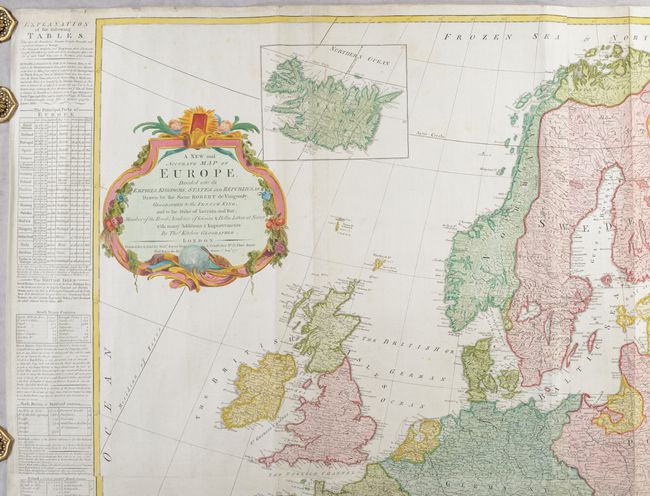
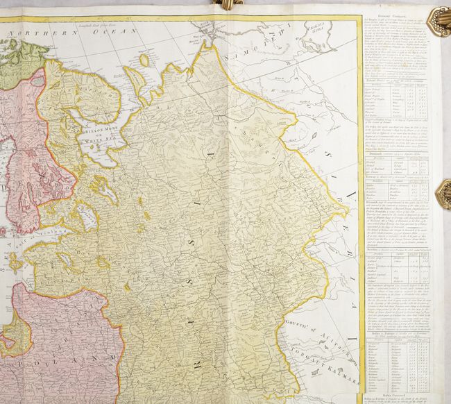
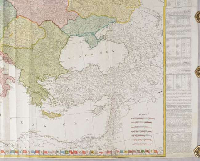
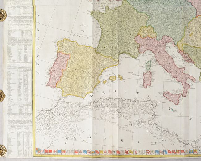
This is Kitchin's version of Robert de Vaugondy's detailed four-sheet map of Europe. Germany, Poland, Hungary and Turkey encompass nearly all of central and eastern Europe. Named places are shown in abundance and boundaries are included. An inset of Iceland appears above the decorative title cartouche. Tables at sides provide a wealth of information on the major empires, and the flags of all the nations are aligned along the bottom of the southern sheet. This edition was published by Robert Sayer. Printed on four sheets, joined.
References: Phillips (Atlases) #653-3 & 4.
Condition: B+
A nice impression on bright sheets with Strasbourg Lily watermarks, very minor soiling, some extraneous creases, and tiny chips and tears along the edges of the sheet. There are a few short tears and fold separations in the image that have been archivally repaired on verso.