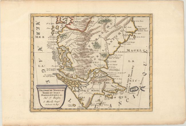
Subject: Tierra del Fuego
Period: 1699 (circa)
Publication: Description de Tout l'Univers
Color: Hand Color
Size:
9.4 x 7.6 inches
23.9 x 19.3 cm
A charming small map of Tierra del Fuego showing both the Strait of Magellan and Le Maire Strait. Inland detail is confined to a mountain range and several rivers, and the mythical Destroit de Browers is labeled at far right. Adorned with a decorative title cartouche. Engraved by Antoine d'Winter. This is the second state, with the addition of a graticule.
Sanson's small maps from his L'Amerique en Plusieurs Cartes..., first published in 1657 and engraved by A. Peyrounin, were copied several times by various map publishers. Johann David Zunners made copies of Sanson's maps for his German translation of Die Gantze Erd-Kugel in 1679. Johannes Ribbius and Simon de Vries published copies in 1682 and 1683, with new maps engraved by Antoine d'Winter. The plates were later sold to Francois Halma, who used them in 1699 and then again in 1705 with the titles re-engraved in Dutch. The titles on the d'Winter plates were re-engraved back into French, and then used by Nicholas Chemereau in 1715 and by Henri du Sauzet in 1738.
References: cf. Pastoureau, SANSON II F #15.
Condition: A
A crisp impression with light toning along the sheet's edges, well away from map image.