Subject: Chile
Period: 1631 (published)
Publication: Appendix Theatri ... et Atlantis
Color: Hand Color
Size:
18.9 x 14 inches
48 x 35.6 cm
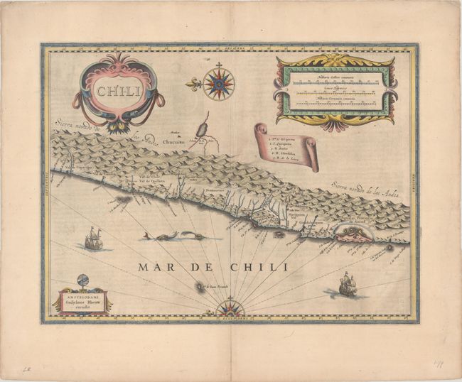
This striking map covers the known coastal region of Chile from around Antofagasta in the north to Cabo Gallegos in the south. The map is oriented with north to the left with two bold compass roses. The Andes are prominently shown, with two live volcanoes in the vicinity of Villarrica. Beyond the mountains, in what is now Argentina, there is a large unnamed (and nonexistent) lake and the cities of Mendoza and San Juan - with San Juan incorrectly placed to the south of Mendoza. Otherwise, the map is surprisingly accurate for its age with many recognizable place names, including La Serena, S. Iago (Santiago), Concepcion, Valdivia, and the Gulf of Ancud. It is beautifully adorned with three large cartouches, a scroll-style key, sailing ships, and sea monsters. Latin text on verso.
References: Van der Krogt (Vol. II) #9920:2.2.
Condition: B+
A dark, early impression on a bright sheet with light printer's ink residue and two tiny tears near the center of the map. There are archival repairs to centerfold separations at top and bottom and to a short tear in the top margin.