Subject: Washington
Period: 1883 (dated)
Publication:
Color: Printed Color
Size:
29 x 21.9 inches
73.7 x 55.6 cm
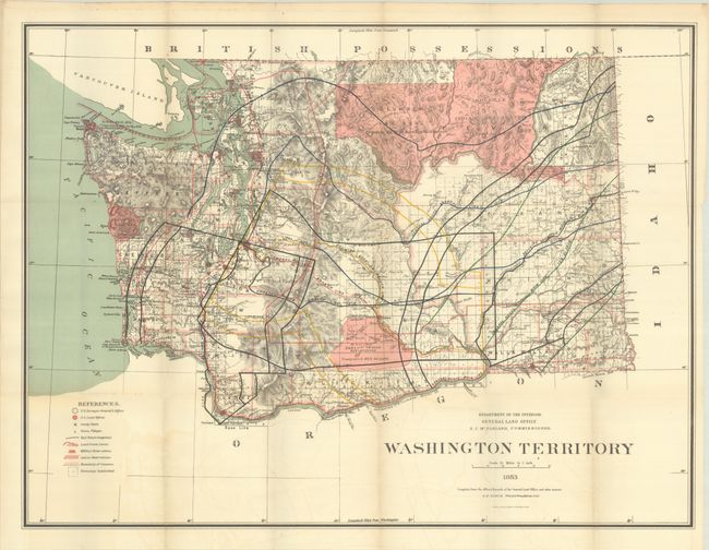
This colorful and graphic map of the territory provides great detail throughout. It locates Indian reservations, military reservations, county boundaries, railroad lines, and the extent of public surveys. Topography and watersheds are well developed and railroad land grants are clearly shown with 40 and 50 miles limits indicated through color overprinting. Red shaded areas identify Indian reservations and applicable treaties are referenced. Several areas remain to be surveyed. Washington was admitted to the Union in 1889.
References:
Condition: A
Issued folding on a clean sheet with faint offsetting.