Subject: Virginia
Period: 1801 (published)
Publication: Carey's American Pocket Atlas
Color: Black & White
Size:
7.7 x 5.8 inches
19.6 x 14.7 cm
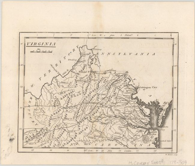
Mathew Carey was a seminal figure in early American publishing; establishing the first publishing firm to specialize in cartography and issuing the first atlas devoted exclusively to American maps. He set up an elaborate cottage system of craftsmen for compiling, engraving, printing, and coloring maps. This practice was emulated by later American cartographic publishers such as John Melish and Henry S. Tanner. The American Atlas concept was also adopted by other publishers in both the United States and Europe.
This map of Virginia was copied from Scott's map of the state, again showing the western boundary on the western fork of the Big Sandy River rather than the eastern fork. It features fine topographical detail and names several towns and cities, including Washington City (not yet the District of Columbia), Richmond, Charlotteville, and, outside the state, Pittsburg. Ohio is still N.W. Territory, and Onancock is labeled Onaucook. This is the second state with the addition of the place names W. Liberty, Wheeling, and Fishing C along the Ohio River. Engraved by W. Barker.
References: Wheat & Brun #570; Wooldridge #178.
Condition: B+
Minor staining along the centerfold and excess printer's ink in left margin.