Subject: Texas Cities
Period: 1950-51 (dated)
Publication:
Color: Printed Color
Four post-WWII pocket maps by J. Foster Ashburn of Texas cities prior to their rapid growth in the second-half of the twentieth century. All are self-folding with pictorial wrappers.
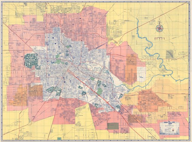
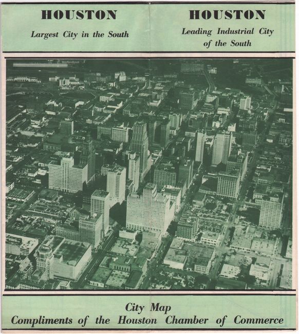
A. Ashburn's Houston City Map, dated 1950 (24.4 x 18.2"). A highly detailed street map of Houston that extends to include Jacinto City, Pasadena, South Houston, and Bellaire. Decorative map title features oil derricks. Condition: (A+)
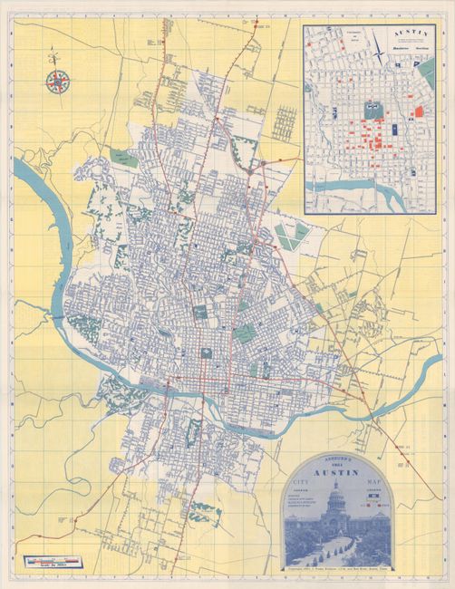
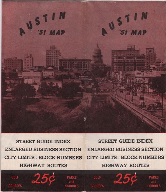
B. Ashburn's Austin City Map, dated 1951 (16.6 x 21.3"). Presents the street-grid pattern of the city with an inset map of downtown at top right. The title at bottom right is surrounded by a photographic illustration of the state capitol. The verso includes a street index and bird’s-eye view of the University of Texas. Condition: (A+)
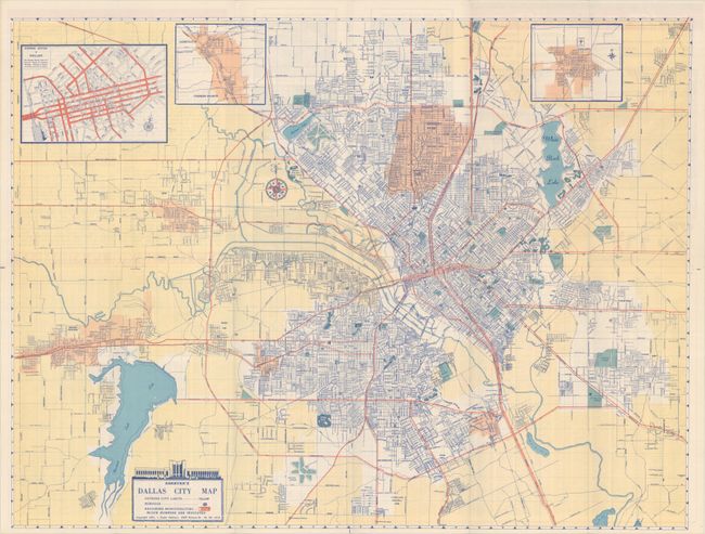
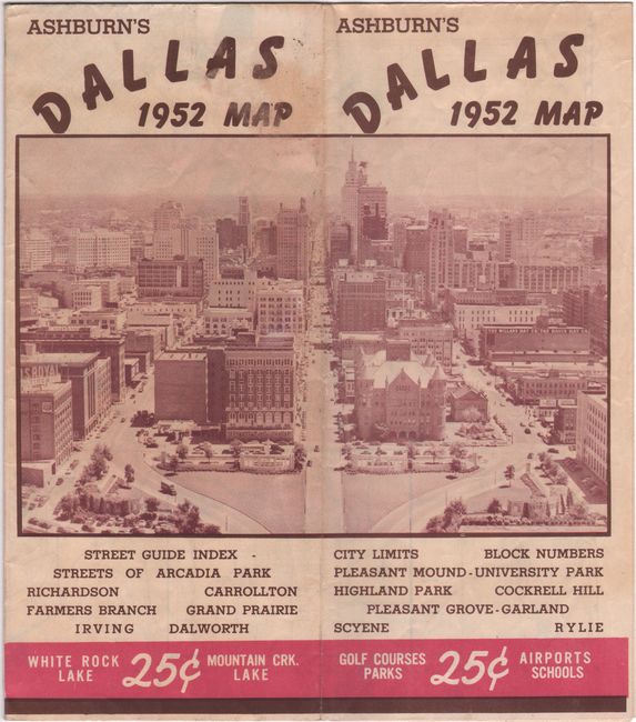
C. Ashburn's Dallas City Map, dated 1951 (24.2 x 18.4"). A colorful map of the Dallas region with adjoining municipalities are highlighted in orange, outside of city limits in yellow, and airports and cemeteries in blue. Includes insets of downtown, Carrolton, and Garland. Pictorial wrappers feature a double-page aerial view of the city. Condition: Clean and bright with light wear and minor cockling. (B+)
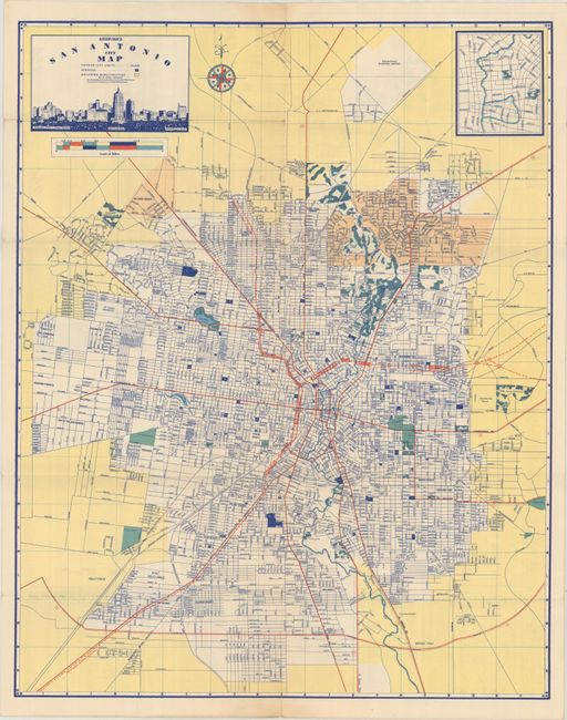
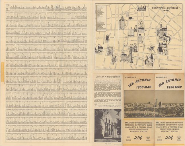
D. Ashburn's San Antonio City Map, dated 1950 (18.1 x 22.8"). A detailed map of the city extending to the municipal airport in the north. Includes an inset of the downtown area at top right. Title features a skyline view of the city. The verso contains an unusual "Downtown Pictorial Guide" and street index. Condition: There is light wear and a couple of tiny splits at the fold junctions. (B+)
J. Foster Ashburn was based out of Fort Worth and mostly produced maps of cities in Texas and the South. They are easily distinguished by their bright coloring and the frequent illustrated main titles done by Melvin Warren who became a noted Western artist. Unlike most mapmakers of the period, Ashburn was “vertically integrated,” handling all the production work in house, including printing.
References:
Condition:
Issued folding. See description above for additional condition details.