Subject: Texas
Period: 1877 (dated)
Publication:
Color: Hand Color
Size:
21.7 x 14.3 inches
55.1 x 36.3 cm
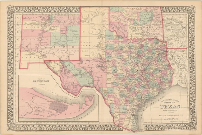
This attractive, double-page map of Texas extends to include most of New Mexico to above Santa Fe and the adjoining parts of Oklahoma, Arkansas and Louisiana. The map presents an excellent view of county development with only the large regions of West Texas yet to be fully organized. Galveston’s role as a main port of entry is obvious as it is depicted in a large inset. The Llano Estacado, or Staked Plain, is shown extending from the New Mexico Territory through the Texas panhandle. Indian Territory is divided into several large Indian nations and reservations. The map is surrounded by Mitchell's distinctive grapevine border. Drawn and engraved in Philadelphia by W. H. Gamble.
References:
Condition: A
There is a hint of toning and a few minor spots of soiling.