Catalog Archive
Auction 191, Lot 321

Last Map of Oklahoma Territory

"Oklahoma Territory. Compiled from the Official Records of the General Land Office and from Data on File in the Executive Office of the Territory...", General Land Office
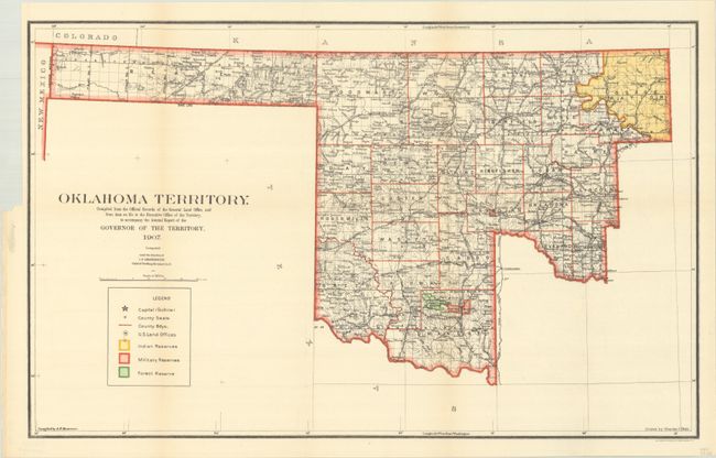
Subject: Oklahoma

Period: 1907 (dated)

Publication:

Color: Printed Color

Size:
22.1 x 13.9 inches
56.1 x 35.3 cm
Download High Resolution Image
(or just click on image to launch the Zoom viewer)

Oklahoma Territory was created in 1890. After the addition of the Cherokee Outlet (1893) and Green County (1896) it had the configuration seen here until Oklahoma was admitted as a state in 1907. Thus, this is the last map of Oklahoma as a Territory. It is well detailed with many places, waterways and railroads named. Gutherie is shown as the capital. The colorful map is keyed to a legend in the lower left, which shows the counties, Indian Reservations, Military Reservations, and Forest Reserves. This map was drawn by Charles J. Helm under the direction I.P. Berthrong (1907), Chief of Drafting, from the official records of the General Land Office and from other data on file in the Executive Office of the Territory to accompany the Annual Report of the Governor.

References:

Condition: A

Clean and bright, folding, as issued with a binding trim at left.

Estimate: $100 - $130

Sold for: $150

Closed on 2/8/2023

Archived