Subject: Eastern Ohio
Period: 1814 (circa)
Publication: Carey's General Atlas
Color: Hand Color
Size:
13.6 x 24 inches
34.5 x 61 cm
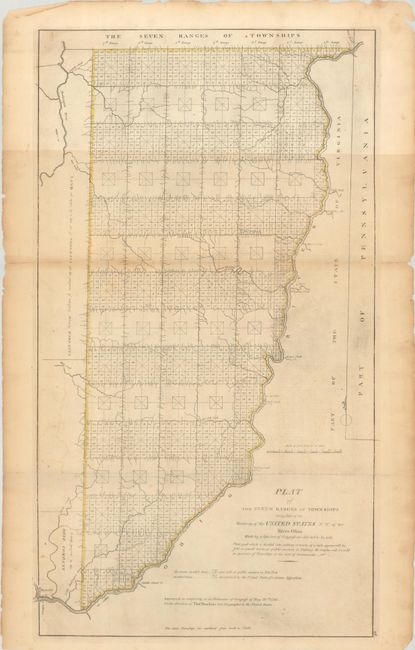
An important early map of eastern Ohio completed under the direction of Thomas Hutchins, who was the first and only official Geographer to the United States. In accordance with the Land Ordinance of 1785, Hutchins conducted the first survey that divided public land into Ranges and Townships, but it was not until 1815 that the township plat, a "planimetric base map that laid down legal subdivisions in each township" assumed its modern form. This government land division approach became the standard throughout the Midwest, South, and West in the 19th century. This map is one of the first of its kind.
References: Phillips (Atlases) #722-28; cf. Wheat & Brun #677.
Condition: B
Issued folding with minor toning, faint offsetting, and a bit of printer's ink residue. There are two short fold separations that have been closed on verso with archival tape.