Subject: Ohio
Period: 1933 (dated)
Publication:
Color: Printed Color
Size:
18 x 19 inches
45.7 x 48.3 cm
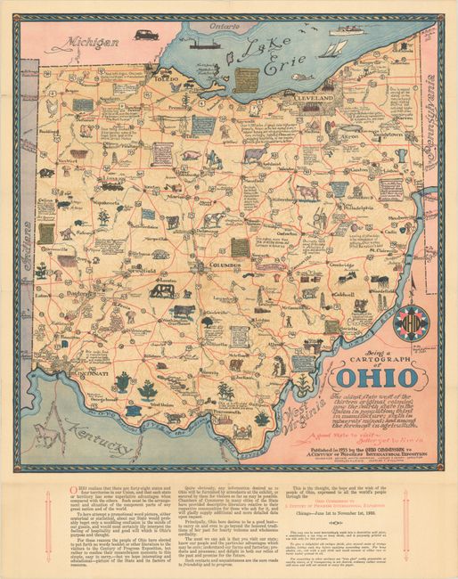
This wonderful pictorial map was issued by the Ohio Commission to a Century of Progress International Exposition to coincide with the Chicago's World Fair in 1933. The text below the map explains the intentions behind the map: "For these reasons the people of Ohio have elected to put forth no wordy booklet or other literature to the visitors to the Century of Progress Exposition, but rather to confine their remembrance memento to this simple, easy to carry, -- but we hope interesting and educational -- picture of the State and its factors of resource." Cities and roads are delineated along with charming pictorial detail of resources, industry, and history. Interesting facts are noted throughout the landscape. The engravings are credited to Bucher Engraving Co. in Columbus, and the cartograph to Sewah Studios in Marietta.
References: Rumsey #8063.
Condition: A
Issued folding with a few small separations along the folds and minor toning.