Subject: New York City, New York
Period: 1858 (dated)
Publication: Manual of the Corporation of the City of New York
Color: Hand Color
Size:
22.7 x 28.4 inches
57.7 x 72.1 cm
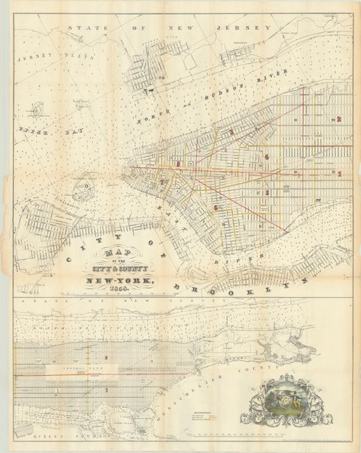
This detailed plan is in two parts; the upper map detailing lower Manhattan up to 39th Street, and the lower map continuing the chart up to King's Bridge. There are soundings throughout the rivers. Outline color delineates the fire districts in red and the ward boundaries in yellow. A pictorial cartouche shows a well-dressed merchant and a Native American chief.
George Hayward was a New York City lithographer best known for his views and maps of New York City, including those published in D.T. Valentine's annual manuals for the city between 1841 and 1866. The manual was a directory with extensive historical and contemporary records related to New York, including ordinances, lists of public officials, ferry schedules, and the directories of hospitals and schools. Many of the maps in the manuals were copies of historical maps; this one however appears to be an original production.
References:
Condition: B+
Issued folding with contemporary color, light toning along the folds, short splits at fold intersections, and some creasing along the edges of the sheet. There is a 3" fold separation at top and a tear at left center that have been closed on verso with archival tape.