Subject: New York City, New York
Period: 1850 (circa)
Publication: Manual of the Corporation of the City of New York
Color: Black & White
Size:
8.3 x 6.1 inches
21.1 x 15.5 cm
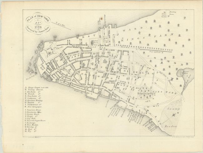
This map of Lower Manhattan is based on the first map of New York that was printed within the city. The original map was created by William Bradford and was based on a survey by James Lyne. It shows wards, buildings, and named streets, and includes a key at left identifying points of interest.
Lithographed by H. R. Robinson for D.T. Valentine's annual manuals for the city between 1841 and 1866. The manual was a directory with extensive historical and contemporary records related to New York, including ordinances, lists of public officials, ferry schedules, and the directories of hospitals and schools. Many of the maps in the manuals were copies of historical maps.
References:
Condition: A
Clean and bright, issued folding with one small paper flaw in the image at top center.