Subject: New Mexico
Period: 1903 (dated)
Publication:
Color: Printed Color
Size:
18.3 x 22 inches
46.5 x 55.9 cm
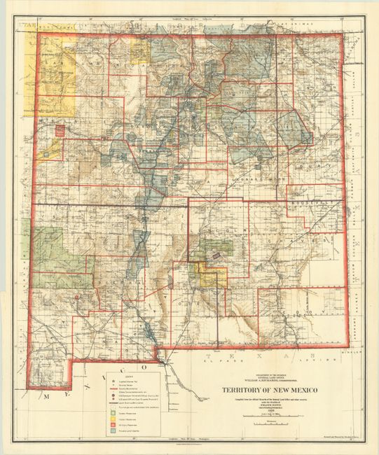
This colorful and fascinating map with great detail was published only nine years before New Mexico obtained statehood. The extent of existing Indian reservations, military reservations, forest reserves and private land grants is shown through color and hash. The map is filled with information on watershed, mountains, railroads, unsurveyed townships, and more. In 1903, Guadalupe county was renamed Leonard Wood and then returned to Guadalupe in 1905. This is the only map we are aware of that shows the short-lived county of Leonard Wood. The map was compiled by Frank Bond, Chief of Drafting Division. Revised and traced by Charles J. Helm.
References:
Condition: A
Issued folding on a clean sheet with a tiny binding tear confined to the left blank margin.