Subject: Michigan
Period: 1825 (published)
Publication: Atlas Geographique, Statistique, Historique ... des Deux Ameriques
Color: Hand Color
Size:
10.5 x 14.3 inches
26.7 x 36.3 cm
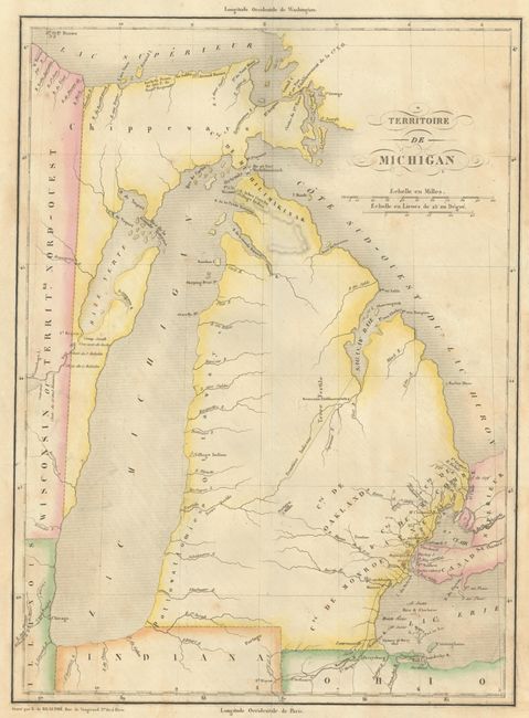
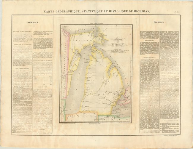
This early map of Michigan Territory is from the French edition of the Carey and Lea atlas. The western boundary is shown on a line 10° 30' West Longitude from Washington, resulting in Green Bay and a strip of present-day Wisconsin being incorporated into Michigan. The Frontiere Indienne divides lower Michigan on a diagonal line. The only settlements shown are in the southeast around Detroit, and along the Saginaw River is a Nouveaux Establissements. The initial counties of Michilimakinak, Monroe, Oakland, DeWayne, and Macomb are named but not delineated. There is a road depicted from Ft. Wayne, Indiana, to Mt. Clemens. The rest of the territory is virtually blank except for a few portages and Indian villages. Several battlegrounds from the War of 1812 are located by tiny flag symbols. The sheet with text measures 27.6 x 21.3" and includes panels of French text providing a detailed history of the region with the total population of 8,496 divided among seven counties.
References:
Condition: B+
There is some light uneven toning.