Subject: Massachusetts
Period: 1930 (dated)
Publication:
Color: Printed Color
Size:
32.9 x 22 inches
83.6 x 55.9 cm
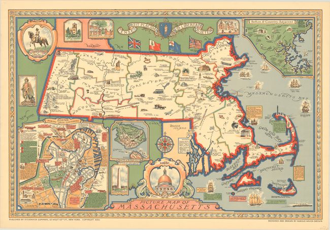
This handsome map iilustrating the history of the state was designed and drawn by Harold Haven Brown. It covers a period of 300 years from the Mayflower landing at Plymouth Rock, to the Boston Tea Party, to Nantucket and New Bedford whaling. Numerous places and events are described along with insets "Boston During Three Centuries", "Boston & Country Adjacent", and "Battle of Bunker Hill." Decorated by the state’s coat of arms and four flags. Published by R.R. Bowker Company in New York.
References:
Condition: A
Vivid color on a clean sheet with two tiny edge tears and minor creasing all confined to the right blank margin.