Subject: Maryland
Period: 1801 (circa)
Publication: American Pocket Atlas
Color: Black & White
Size:
7.8 x 5.9 inches
19.8 x 15 cm
Mathew Carey was a seminal figure in early American publishing; establishing the first publishing firm to specialize in cartography and issuing the first atlas devoted exclusively to American maps. He set up an elaborate cottage system of craftsmen for compiling, engraving, printing, and coloring maps. This practice was emulated by later American cartographic publishers such as John Melish and Henry S. Tanner. The American Atlas concept was also adopted by other publishers in both the United States and Europe.
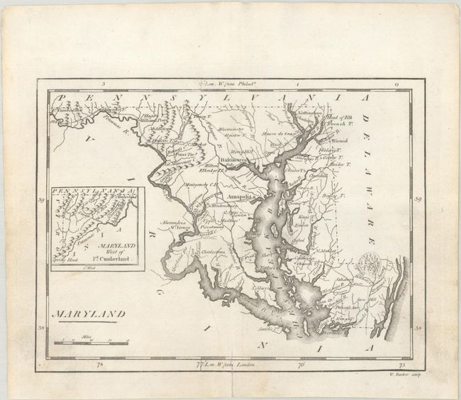
A detailed map of the state showing numerous settlements, towns, and cities including Baltimore, Annapolis, and Washington. Several early wagon roads are depicted including from Georgetown to near Fort Cumberland, Annapolis to Baltimore via Bladensburg, and Queens Town to Head of Elk. Includes a small inset of western Maryland on the same scale. This is the second state of the map with the District of Columbia outlined.
References: Wheat & Brun #513.
Condition: A
A crisp impression with a bit of soiling and a professionally repaired short centerfold separation at bottom.