Catalog Archive
Auction 191, Lot 268

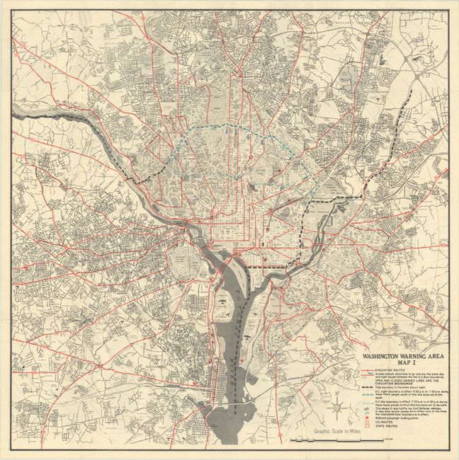
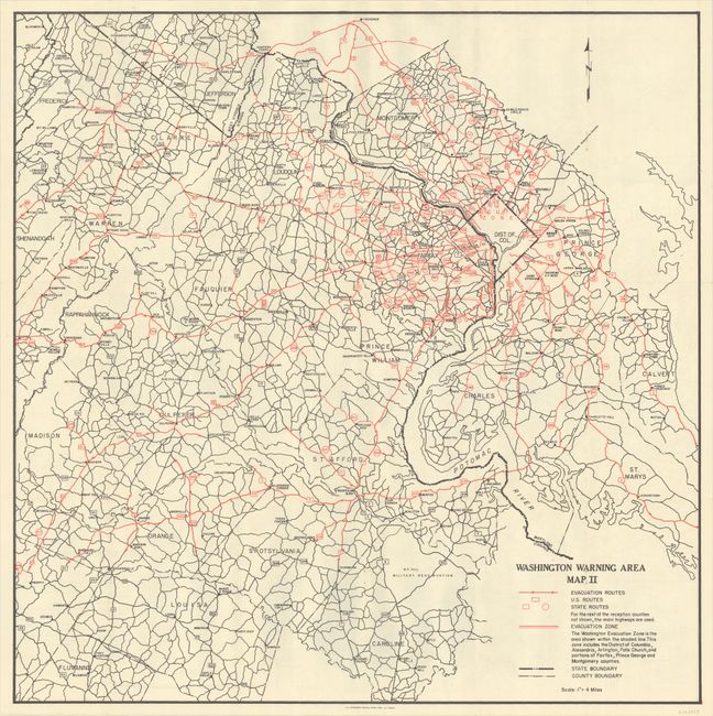
Map Artifact of Nuclear War Preparations for Washington, D.C.

"Washington Warning Area Map I [on verso] Washington Warning Area Map II", U.S. Government

Subject: Washington, D.C.

Period: 1959 (dated)

Publication:

Color: Printed Color

Size:
27 x 27.1 inches
68.6 x 68.8 cm
Download High Resolution Image
(or just click on image to launch the Zoom viewer)

This sheet contains two maps issued by the Office of Civil and Mobilization Defense. One side shows the immediate Washington D.C. area in fine detail, while the other side depicts the broader region extending from Frederick, Maryland to Central Virginia. The maps identify evacuation routes, railroad passenger loading points, boundaries, state and federal highways, and more. They are artifacts of nuclear war preparation of the Cold War era which peaked with the Cuban missile crisis of 1962. Federal officials assumed that Washington would be a primary target for an attack and planned accordingly.

References:

Condition: A

Issued folding on a clean bright sheet. There are a few tiny holes along the upper folds only visible when held to light.

Estimate: $180 - $220

Sold for: $110

Closed on 2/8/2023

Archived