Subject: Washington, D.C.
Period: 1908 (dated)
Publication:
Color: Printed Color
Size:
53.5 x 52.5 inches
135.9 x 133.4 cm
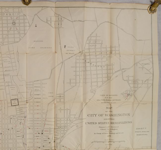
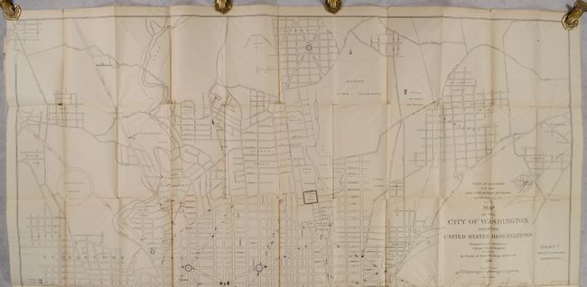
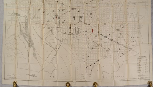
This massive map of the city of Washington was prepared under the direction of Colonel Theodore A. Bingham. It presents the street-grid pattern of the city with many important buildings identified including the Washington Monument, Smithsonian, Executive Mansion, Capital, Navy Yard, and many more. The map extends to include Georgetown as well as Rosslyn and Arlington across the Potomac River. It accompanied the 1909 Senate report Title of the United States to Lands in the District of Columbia and was intended to present “a comprehensive statement of the land owned by the United States in the District of Columbia.” Printed on two sheets and joined. First issued in 1900 and updated here to 1908. Lithographed by Julius Bien in New York.
References:
Condition: B+
Issued folding on a clean sheet with numerous short splits at the fold junctions. There is a 1.75" tear in the text at bottom right and a 3" fold separation at top. Overall very good condition given the paper and map's size.