Catalog Archive
Auction 191, Lot 260

"Colorado [on verso] Indian Territory", Mitchell, Samuel Augustus

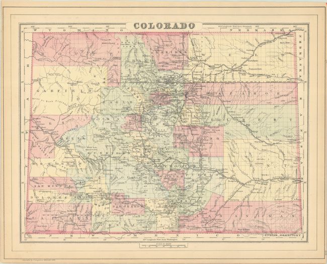
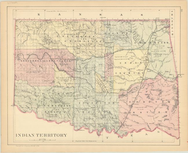
Subject: Colorado & Oklahoma

Period: 1884 (dated)

Publication:

Color: Hand Color

Size:
15 x 11.9 inches
38.1 x 30.2 cm
Download High Resolution Image
(or just click on image to launch the Zoom viewer)

This detailed map shows the status of settlement and development eight years after Colorado became a state. It presents railroads, cities, towns and mining communities, watershed, forts, and more. What was once the large Confederate Ute Indian Reservation in the west is replaced by the counties of Garfiled, Mesa, Delta, and Montrose. Features good topographical detail via hachure. This is one of the few Mitchell atlas map years showing Colorado separately. Includes a map of Indian Territory on verso.

References:

Condition: A

Light toning along the edges of the sheet.

Estimate: $100 - $130

Sold for: $160

Closed on 2/8/2023

Archived