Subject: Alaska, Klondike Region
Period: 1897 (circa)
Publication:
Color: Printed Color
Size:
50 x 27.5 inches
127 x 69.9 cm
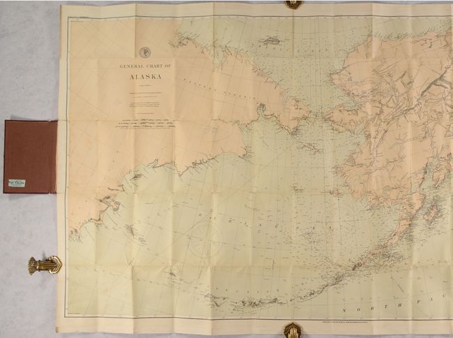
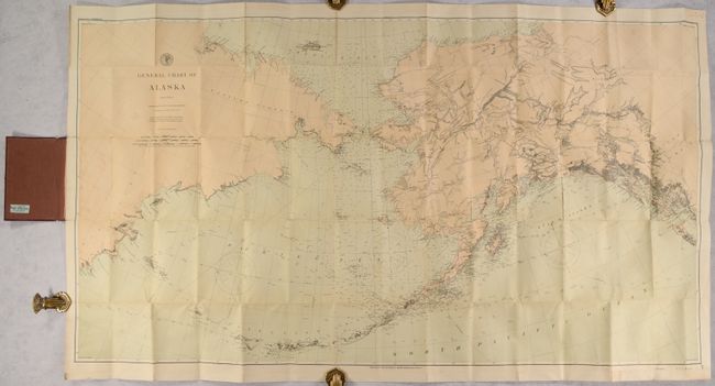
This large map of Alaska was first published by the Coast & Geodetic Survey in 1890 and updated here by Rand McNally to reflect the gold discoveries in the Klondike Region (in Canada’s Yukon Territory along the Alaskan border). Gold was discovered there in August 1896 and tens of thousands of eager prospectors arrived months later (some likely using this map). Names Dawson, Fort Reliance, Old Reid House, Ed Dorado Creek, the Klondike River, and more.
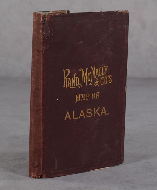
Outside of the Klondike, the chart shows particularly good detail along the coastlines and Aleutian Islands including hundreds of soundings. In the interior, mountains, rivers, forts and numerous Indian villages are identified. The chart extends to include a large section of the Russian coastline. Imprint below the bottom border states “Transferred to Stone and Printed by Andrew B. Graham, Washington DC.” Folds into maroon cloth covers (4.2 x 6.7”) with gilt title on the front cover.
References:
Condition: B+
Issued folding and backed on linen with several small fold separations with minor loss at a couple of fold junctions at right. There is some light soiling and a bit of staining at left where the map is glued to the rear board. Covers have average wear.