Subject: Washington & Oregon
Period: 1853 (dated)
Publication:
Color: Hand Color
Size:
15.6 x 11.9 inches
39.6 x 30.2 cm
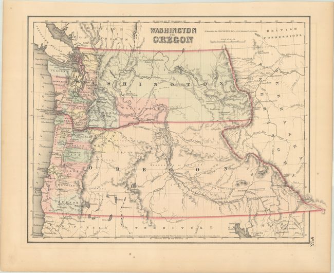
A great map of the Pacific Northwest showing both territories extending to the Continental Divide and incorporating the region that would become Idaho. Of specific interest is the notation of all the major exploration routes, wagon trails, and the proposed routes for the transcontinental railway as explored by Gov. Stevens. A few organized counties are confined to a narrow band along the coast and Wascopen, Skamania, and Walla Walla are the only counties east of the Cascade Range. Dated 1853 but published circa 1857.
References:
Condition: A
There is minor offsetting of the border and a couple of small spots.