Catalog Archive
Auction 191, Lot 207

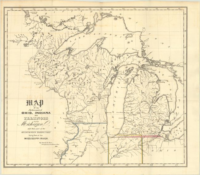
"Map of the Northern Parts of Ohio, Indiana and Illinois with Michigan, and That Part of the Ouisconsin Territory Lying East of the Mississippi River", Burr, David H.

Subject: Upper Midwestern United States

Period: 1836 (dated)

Publication:

Color: Hand Color

Size:
14.9 x 13.1 inches
37.8 x 33.3 cm
Download High Resolution Image
(or just click on image to launch the Zoom viewer)

This map covers the region from northern Ohio west to the Mississippi River and north to Lake of the Woods. A small but important sliver of land highlighted in pink reflects a boundary dispute between Ohio and Michigan - one that saw Ohio block admission of Michigan to the Union until the question was settled. The map also notes Indiana's revised northern boundary. Wisconsin came from the term "Ouisconsin" which is believed to mean "grassy place" in the Cheppewa tongue.

References: Claussen & Friis #144; Karpinski #135.

Condition: B+

Issued folding with faint offsetting and a 1.75" edge tear at left that has been archivally repaired on verso.

Estimate: $180 - $220

Sold for: $500

Closed on 2/8/2023

Archived