Subject: Central United States
Period: 1860 (circa)
Publication: Smith's Geography
Color: Hand Color
Size:
10.8 x 12 inches
27.4 x 30.5 cm
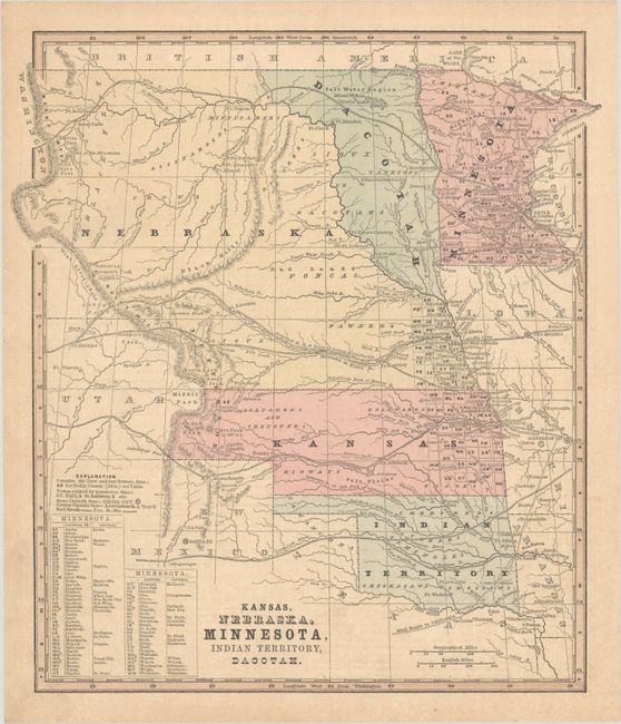
The main feature of this map is the desirable depiction of Jefferson Territory, named here along the Front Range of the Rocky Mountains. It also shows an early appearance of Denver, Auraria (just above Denver), and Puebla. This extralegal and unrecognized territory of the United States existed from October 24, 1859 until the creation of the Colorado Territory on February 28, 1861. St. Charles, the first name given for Denver, is erroneously shown just to the west of Pueblo with Denver correctly located well to the north. The map features large territories including Nebraska which stretches from the Rocky Mountains to the Missouri River, and Kansas which extends to the Rocky Mountains at the Front Range, overlapping Jefferson Territory. The map includes numerous proposed railroad routes throughout the west with many forts and Indian tribes located.
References:
Condition: B+
Minor toning.