Subject: Central United States
Period: 1846 (dated)
Publication:
Color: Black & White
Size:
24 x 13 inches
61 x 33 cm
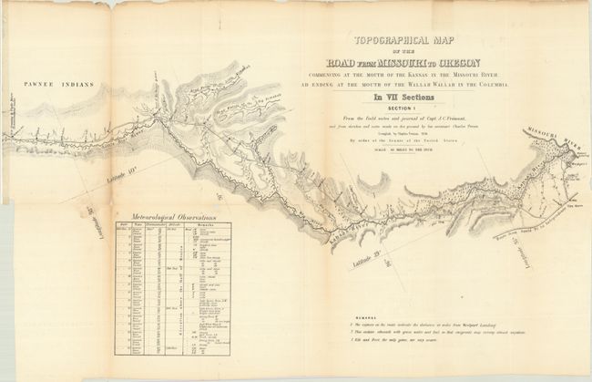
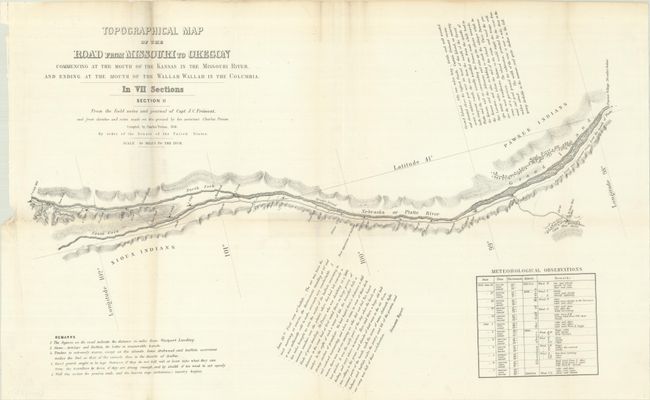
This lot includes the first 2 sections (of 7) of the historic map that established the Oregon Trail Route. It was compiled by Charles Preuss during Fremont's controversial Third Expedition. Preuss created the seven-part map from Fremont's 1845 map along with additional topography based on Fremont's sketches and notes as well as his own expedition notes. Wheat calls this set a rarity that is important in the "evolution of the transcontinental wagon roads" and deserves "close study." Wheat devotes four pages to describe the map and illustrates all seven sheets in his monumental work.
These two sheets cover the eastern section of the "road" from the confluence of the Kansas/Missouri Rivers to beyond Cedar Bluffs on the North Fork of the Platte River. The sheets contain fascinating comments from Fremont's narrative, and notes regarding water, grass, fuel, game and Indians; invaluable information for emigrants at the time.
References:
Condition: B
The first sheet has light toning along the folds, several archivally repaired fold separations, and minor loss at a fold junction and along one fold. The second sheet has several fold separations along the vertical fold repaired with old tape with minor tape stains visible on recto.