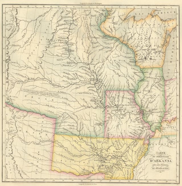
Subject: Central United States, Arkansas Territory
Period: 1825 (published)
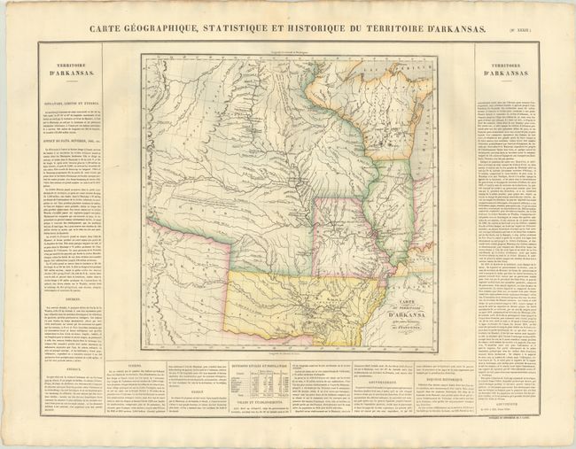
Publication: Atlas Geographique, Statistique, Historique ... des Deux Ameriques
Color: Hand Color
Size:
14.4 x 14.3 inches
36.6 x 36.3 cm
Reflecting Stephen H. Long's exploratory expedition, this is an important map of the early western territories. The Long expedition ranks with the expeditions of Lewis & Clark and Zebulon Pike in important explorations of the Trans-Mississippi West. Among other important aspects of the map are the depictions of the major rivers crossing the plains. The map extends to the headwaters of the Missouri in the north and to Santa Fe in the south. The plains are labeled Grand Desert, a term coined by Long. Numerous Indian villages are shown, based on information gained from the Lewis and Clark expedition, along with additional important exploration routes. The map shows a large Arkansas Territory extending to include present-day Oklahoma and an early Missouri western border. The western portions of the map are identical to Long's map of 1823, also published by Carey & Lea. French text surrounds the map on three sides of the large folio sheet (27.6 x 21.3"). The second title listed is in the upper margin above the neatline. The map was originally engraved by Young & Delleker in 1822, and published by Carey and Lea. This is their French version published by Buchon which was issued on finer paper and usually found in much better condition than his American counterparts.
References: Phillips (Atlases) #1176-39; cf. Wheat (TMW) #348.
Condition: A
A nice impression with contemporary color on a sturdy sheet with a hint of toning.