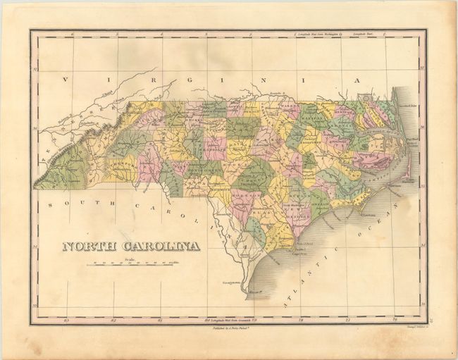
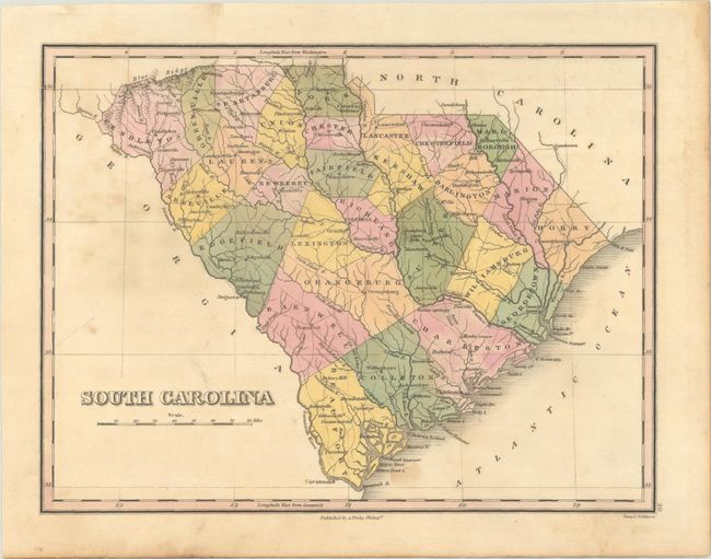
Subject: North Carolina & South Carolina
Period: 1824 (published)
Publication: A New General Atlas
Color: Hand Color
Size:
11.5 x 8.6 inches
29.2 x 21.8 cm
Finely's maps employ a delicate and elegant engraving style and provided extensive topographical and watershed information. He was the dominant map maker in the United States in the early 1820s into the 1830s. His atlases were very successful, outselling rival atlases by Carey & Lea, and Tanner. His maps were printed on high quality paper and were routinely corrected and updated.
This lot features maps of the Carolinas from Finley's New General Atlas. Each is delineated by county and shows good detail of roads, towns and settlements. Finely engraved by Young & Delleker. Finley published his atlases nearly annually between 1824-1834, with one final edition appearing in 1836 (Ristow states his last atlas was 1834).
A. North Carolina. County configurations are up-to-date to circa 1822 with the addition of Davidson County in the middle of the state.
B. South Carolina. This early map of the state delineates only 28 counties. The county configurations are current to publication and pre-dates 1826, when Pendleton was split into Anderson and Pickens.
References: Ristow, pp. 268-70.
Condition: B
Contemporary color with scattered foxing.