Catalog Archive
Auction 191, Lot 189

"Karte von den Kusten des Franzosischen Florida nach den Ersten Entdeckungen Entworffen", Bellin, Jacques Nicolas

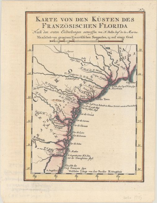
Subject: Colonial Southeastern United States

Period: 1756 (published)

Publication: Allgemeine Historie der Reisen zu Wasser und Lande…

Color: Hand Color

Size:
5.8 x 8.1 inches
14.7 x 20.6 cm
Download High Resolution Image
(or just click on image to launch the Zoom viewer)

This uncommon map is a German copy of a map first published in Charlevoix's History of New France. It covers the coast from Cape Fear to St. Augustine and shows the locations of Spanish, French, and English settlements in the region. There are several errors of location including the misplacement of James Town and Charles Town together. A notation (in German) shows the location of Charlesfort that was built by the French explorer Jean Ribault on Parris Island in South Carolina. It also provides both Ribault's rivers' names, as well as the contemporary names.

References: Cumming (SE) #305.

Condition: A

A crisp impression with just a hint of marginal toning.

Estimate: $140 - $170

Sold for: $90

Closed on 2/8/2023

Archived