Subject: United States
Period: 1952 (circa)
Publication:
Color: Printed Color
Size:
31.3 x 23.2 inches
79.5 x 58.9 cm
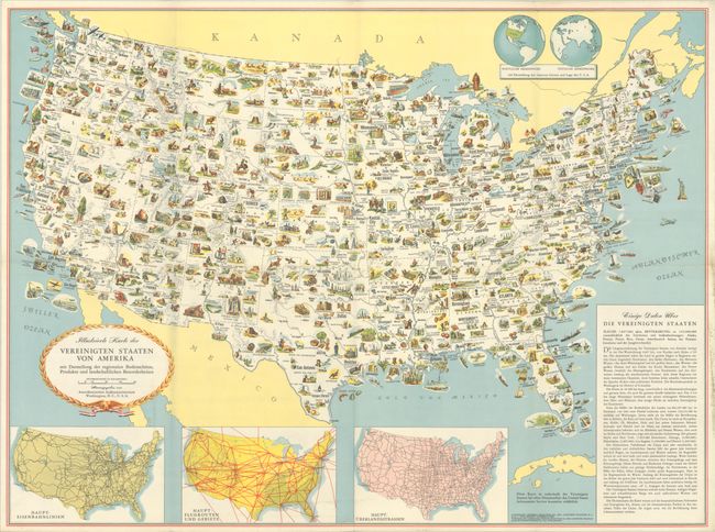
This pictorial map was created by General Drafting Co. and was published in numerous editions in different languages around the 1950s, possibly to counteract propaganda created by the Soviet Union during the Cold War era. This German-language edition is packed with information and features hundreds of drawings in full color including points of interest, natural resources, and agricultural products. At bottom are inset maps showing railroad lines, air routes, and highways. At top is a double-hemisphere map of the world showing the location of the United States. Published by the U.S. Department of State in Washington, D.C.
References: P.J. Mode Collection #1368; Rumsey #12475.
Condition: A
This map was issued folding and has been backed in linen with minor extraneous creasing and wear along the folds. There is light soiling that is mostly confined to the blank margins, with the exception of a bit at bottom center.