Subject: Western England
Period: 1695 (circa)
Publication: Camden's Britannia
Color: Black & White
Size:
16.6 x 14.2 inches
42.2 x 36.1 cm
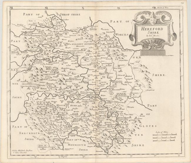
This county map of Herefordshire shows the early road system, with the town of Hereford located at the center of the sheet. The county is divided into eleven Hundreds and shows numerous place names, churches, rivers, and topography. Decorated by an attractive title cartouche and three distance scales. Sold by Abel Swale Awnsham and John Churchill.
Morden was one of the first English cartographers to show longitudes measured from the meridian of St. Paul's Cathedral (shown in degrees at the bottom of the map) and time in minutes measure locally from the sun (shown at the top in Roman numerals). The roads on his maps are based on Ogilby's earlier survey. The Britannia was first published by historian William Camden (1551-1623) in 1586. After the publication of the final edition of Britannia in 1637, the work was not published again until 1695 when Gibson revised and translated the text from the original Latin. He included fifty maps, mostly of the English counties, prepared by Robert Morden, replacing the outdated maps of Christopher Saxton.
References: Shirley (BL Atlases) T.CAMD-5a.
Condition: A
A crisp impression with faint toning along the centerfold.