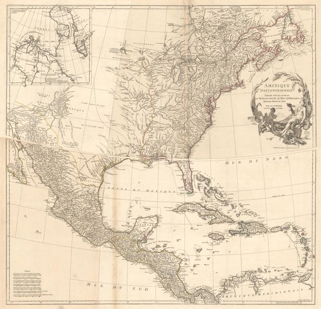
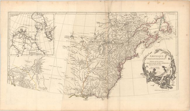
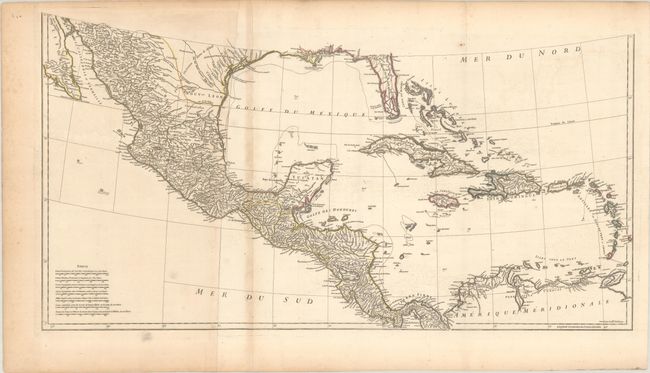
Subject: Colonial North America
Period: 1746 (dated)
Publication:
Color: Hand Color
Size:
34.2 x 18 inches
86.9 x 45.7 cm
This striking map of North America and the West Indies was one of the best French maps of North America prior to the French & Indian War. D'Anville was the Royal Geographer and Cartographer to the King of France. He followed Delisle as the chief proponent of scientific cartography, and his influence on his contemporaries was profound. Because he had direct access to the many official French records of North America his maps are known for their excellent detail and clearly presented information. This map provides good information in New Mexico and the Mississippi and Missouri River Valleys. A remnant of Lahontan's fabled Grande Rivier is retained west of Lac du Bois. The region of the Ohio River Valley and below the Great Lakes reflects the superior knowledge of the French in these regions. The newly formed colony of Georgia appears squeezed between South Carolina and the Spanish claims to Florida. The map names Tecas and includes a notation on the Texas coast concerning Port Francois referring to La Harpe's expedition. Many place names, Indian tribes, and forts are located. At upper left is an inset of Hudson and Baffin Bays. Map engraved by Guillame Delahaye, decorative cartouche drawn by Graevlot and engraved by Major. Printed on four sheets of heavy paper, joined in two horizontal segments.
References: Karpinski (MI) p. 138; Lowery #381; Tooley (Amer) pp. 316-17; Tooley (MCC-68) #103.
Condition: B+
A nice impression with contemporary outline color on watermarked paper. There is light toning along the folds that were attached to a backstrap, very light offsetting, some creasing along the top centerfold of the northern sheet, and marginal soiling. There are several strips of non-archival tape along the edges of the northern sheet on verso, well away from the image. The first image is a composite image - the maps are joined in two horizontal pairs.