Subject: Colonial North America
Period: 1702 (circa)
Publication:
Color: Black & White
Size:
7.6 x 5.6 inches
19.3 x 14.2 cm
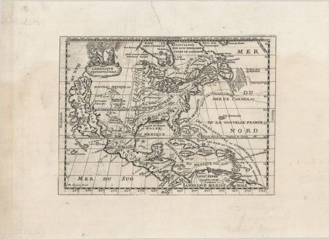
This scarce, charming map is very similar to the De la Feuille map of the same title (McLaughlin #147). It features a huge island of California with an indented coastline on the Fox model and the place names R. d' Estiete, C. Blanco, P. de Carinda, Canal de S. Barbe, I. de S. Martin, I. de S. Marc, B. de S. Francisco, B. de Simon, B.S. Christoue, and Bernabe. The Rio Bravo ou de Nort (Rio Grande) is shown quite correctly for the period with its source in the mountains north of Santa Fe. The map is divided into French, British, and Spanish colonial possessions. The map is decorated with a lovely little figural cartouche, and a ghost of a previously engraved adornment can be seen in the lower left part of the map.
References: McLaughlin #150.
Condition: B+
A nice impression that has been trimmed to the neatline and attached to another sheet to provide ample margins. There is minor offsetting and a few small wormholes in the border at bottom.