Subject: Persia - Iran
Period: 1713-25 (published)
Publication:
Color:
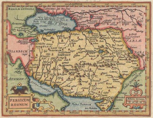
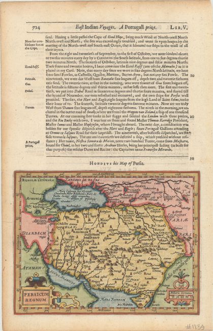
A. Persicum Regnum, by Hondius/Purchas, from Purchas His Pilgrimes..., published 1725, hand color (7.3 x 5.6"). Reduced from Hondius' folio map of the Persian Empire, this small map shows the region from the Caspian Sea to the Persian Gulf. The map is filled with place names and pictorial topography and is adorned with strapwork cartouches for the title and scale of miles. On a sheet of English text measuring 8.3 x 12.9".
At the beginning of the 17th century, Samuel Purchas, an English cleric, set out to publish a compendium of voyages to foreign countries. To illustrate his work, Purchase obtained the rights to use Jodocus Hondius' copperplates from Atlas Minor. Over 60 maps were included in Purchas His Pilgrimes, most of which were from Hondius' plates, with English titles inserted above them. Purchas also had a few additional maps engraved, including those for India, China, Greenland, North America, and Nova Scotia. Reference: Shirley (BL Atlases) G.PUR-1a #12. Condition: A sharp impression with light toning along the edges of the sheet, well away from map image.
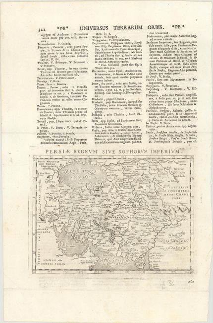
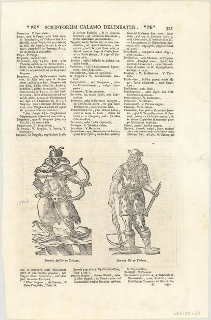
B. Persiae Regnum sive Sophorum Imperium, by Alphonsus Lasor a Varea, from Universus Terrarum Orbis, published 1713, black & white (6.8 x 4.9"). This lovely miniature map of Iran extends from the Caspian Sea to the Gulf of Oman. It is filled with detail of towns, mountains, and topography. The map is beautifully engraved in the Italian style with stippling in the sea and fine calligraphy. Two figures in furs with bows on verso. It first appeared in Magini's Geografia in 1596. The plates were then used by Alphonsus Lasor a Varea for his Universus Terrarum Orbis in 1713. Lasor a Varea, whose real name was Raffaello Savonarola, published his two-volume scriptural and historical dictionary with nearly 500 maps that were taken from old plates by Valegio, Porcacchi, Rosaccio-Franco, and Magini, many of which were more than a century old, and often reworked. On a sheet of Latin text measuring 8.8 x 13.4". References: Phillips (Atlases) #3475 Vol. II #322; Shirley (BL Atlases) T.LAS-1a #365. Condition: The impression is a bit uneven, and there is a horizontal extraneous crease above the map image and a small tear in the left blank margin.
References:
Condition: A
See description above.