Subject: Western United States
Period: 1849-65 (dated)
Publication:
Color:
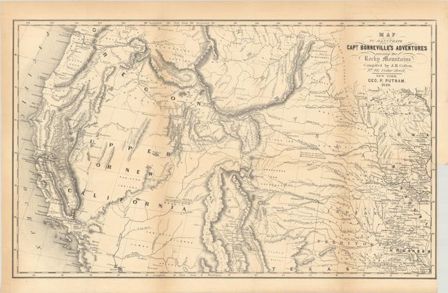
A. Map to Illustrate Capt. Bonneville's Adventures Among the Rocky Mountains, by Putnam/Colton, dated 1849, black & white (18.3 x 11.2"). This interesting map is based on Fremont's map. The river systems are well developed from the Mississippi River to the Pacific Ocean, and the new gold region of California is delineated along with a notation of Sutter's Fort. The expedition route described is that of Captain Benjamin Bonneville who explored the American West from 1832-1836. The expedition party traveled parallel to the course of the Snake and the Columbia Rivers, going as far as Fort Walla Walla before turning back. Fremont's route through California is shown, as well as Kearny's route along the Gila River and the Emigrant route. Condition: Issued folding with light toning along the folds and a short archivally repaired binding tear at right. (B+)
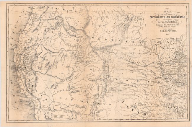
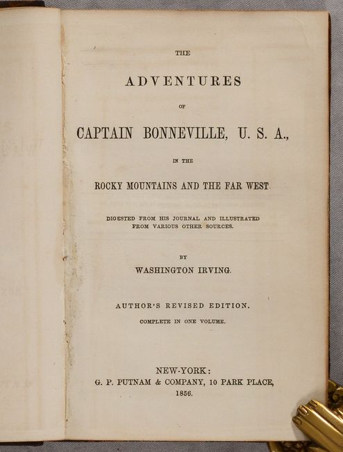
B. [Map with Book] Map to Illustrate Capt. Bonneville's Adventures Among the Rocky Mountains [with] The Adventures of Captain Bonneville, U.S.A..., by Putnam/Colton, dated 1857, black & white (18.3 x 11.8"). This is a later edition of the map laid into the 428-page volume. This version of the map contains more detail in the west and additional development particularly in California. What was previously "Upper or New California" is now divided into Utah Territory, New Mexico Territory, and the state of California. Washington Territory is now carved out of Oregon Territory. Hardbound in quarter leather with tips over marbled boards. Condition: The folding map is very good with light toning along the folds and a short archivally repaired binding tear at right. Text is clean and tight. Binding has light wear. (B+)
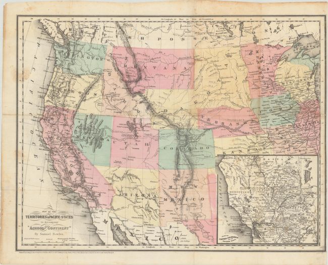
C. Map of the Territories & Pacific States to Accompany "Across the Continent", by Samuel Bowles, dated 1865, hand color (18.1 x 13.9"). A handsome map of the western United States showing the routes of the Union Pacific and Central Pacific railroads, the Butterfield Express and Stage route, mail routes and the tracks of the Colfax expedition. The Spanish Trail and Emigrant Road are also featured on this very detailed map that was engraved by Goldthwait and printed by Colton on banknote paper. The large Dakota Territory includes today's Wyoming and Arizona is still in possession of the southern tip of Nevada. An inset titled Plan of Central California on an Enlarged Scale is at lower right. Condition: Issued folding with scattered foxing and a 9.5" edge tear at right that has been closed on verso with archival tape. (B)
References:
Condition:
See description above.