Catalog Archive
Auction 189, Lot 135

"[Lot of 2] Map Showing Indian Reservations Within the Limits of the United States Compiled Under the Direction of the Hon. W.A. Jones... [and] ... Compiled Under the Direction of the Hon. T. J. Morgan...", U.S. Bureau of Indian Affairs

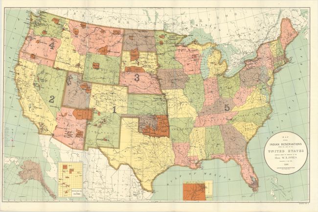
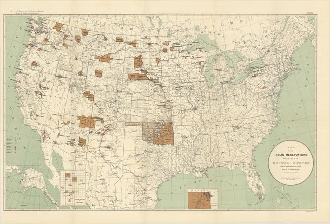
Subject: United States

Period: 1894-1900 (circa)

Publication:

Color: Printed Color

Size:
See Description
Download High Resolution Image
(or just click on image to launch the Zoom viewer)

This lot contains two large maps of the United States focusing on the many Indian reservations at the end of the 19th century. The reservations are named and shown in orange/tan overprinting. The maps also show military stations, towns and villages, railroads, Indian agencies, and schools with keys at lower left. They both include insets of Alaska and reservations in California and Indian Territory at bottom.

A. Map Showing Indian Reservations Within the Limits of the United States Compiled Under the Direction of the Hon. W.A. Jones. Commissioner of Indian Affairs, dated 1900 (33.2 x 21.1").
B. Map Showing Indian Reservations Within the Limits of the United States Compiled Under the Direction of the Hon. T. J. Morgan. Commissioner of Indian Affairs, from Eleventh Census of the United States, circa 1894 (33.4 x 21.1").

References:

Condition: A

Both examples are clean and bright, issued folding.

Estimate: $200 - $250

Sold for: $210

Closed on 9/14/2022

Archived