Subject: United States
Period: 1849 (dated)
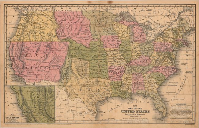
Publication: Mitchell's School and Family Geography
Color: Hand Color
Size:
16.8 x 10.5 inches
42.7 x 26.7 cm
This is the first edition of this United States map showing the important territorial acquisitions of the Mexican-American War, pre-Gadsden Purchase plus the newly discovered gold region in California. The recently acquired Upper California and New Mexico are still shown in their Mexican configurations. The Oregon Territory extends to the Continental Divide. Minnesota Territory includes part of the Dakotas and the huge Missouri Territory rests between the Continental Divide and Minnesota, with Indian Territory bordering on to the south. Indian Territory is in its largest configuration, stretching from Texas to Missouri Territory along the North Fork of the Platte River and extending westward all the way to South Pass. Texas is also shown in an early configuration with a large panhandle. The inset map "No. 6 Map of the Gold Region of California" shows Sutter's Buttes, Sacramento City, and all of the important creeks of the gold region feeding into the Sacramento and Feather rivers.
References:
Condition: B+
Contemporary color with some minor staining and foxing. A short centerfold separation in the bottom margin has been closed on verso with archival tape.