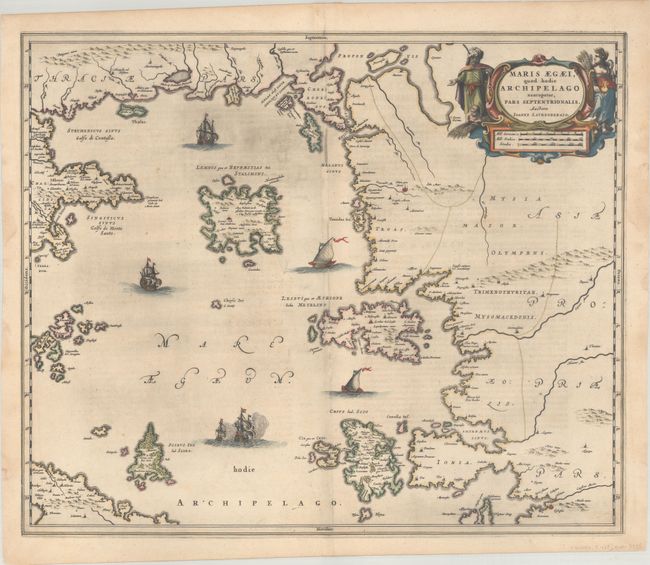
Subject: Aegaen Sea
Period: 1659 (circa)
Publication: Nuevo Atlas
Color: Hand Color
Size:
22.8 x 19 inches
57.9 x 48.3 cm
This exquisitely engraved map covers the North Aegean islands and the Sporades. The larger islands, such as Limnos, Lesbos, Chios, and Skyros, are depicted with numerous place names and nice topographical detail. There are ancient place names lining the coasts, but most of the inland areas are mostly blank. A sea battle and a few sailing vessels fill the Aegean. At top right, an Ottoman Greek and Demeter flank the sumptuous strapwork title and distance scale cartouche. The map was drawn after Johannes Laurenberg, an important cartographic source for all of the major Dutch cartographic publishers of the period. Spanish text on verso, published between 1659-72.
References: Van der Krogt (Vol. II) #7911:2.
Condition: A
A crisp impression and contemporary color on paper with the watermark of Atlas. There is some printer's ink residue at top, a few minor spots, and light dampstaining in the left and right blank margins.