Catalog Archive
Auction 188, Lot 443

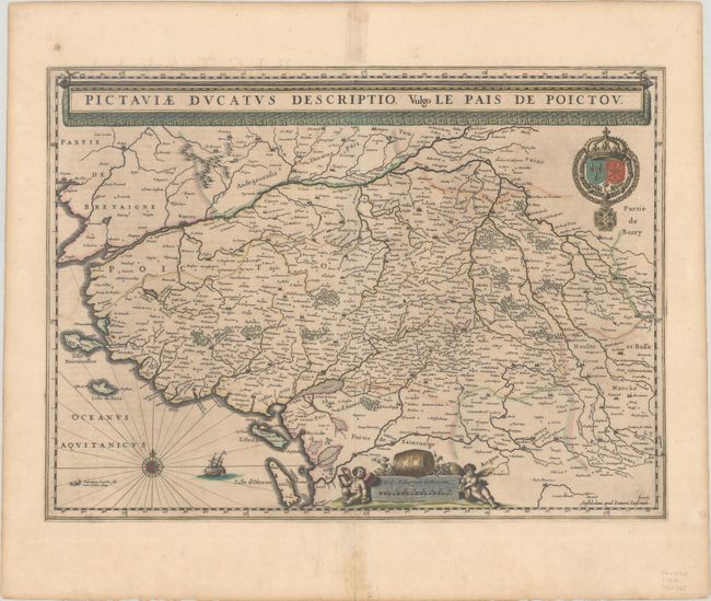
"Pictaviae Ducatus Descriptio, Vulgo le Pais de Poictou", Jansson, Jan
Subject: Western France

Period: 1646 (circa)

Publication: Novus Atlas...

Color: Hand Color

Size:
20.4 x 14.9 inches
51.8 x 37.8 cm
Download High Resolution Image
(or just click on image to launch the Zoom viewer)

Fine map of the region including the coastline and the cities of Nantes and Rochelle prominently delineated. Richly ornamented with a banner style title cartouche, the royal arms, a compass rose, sailing ship, and a distance scale topped by a wine barrel and flanked by two adorable putti. Latin text on verso, published between 1646-57.

References: Van der Krogt (Vol. I) #4500:1C.2.

Condition: B+

Contemporary color with light toning and a repaired centerfold separation at bottom that enters less than 1" into the map image. A small manuscript notation in brown ink in the lower right corner attributes the map to Hondius.

Estimate: $140 - $170

Sold for: $70

Closed on 6/22/2022

Archived