Subject: Europe, World War II
Period: 1944 (dated)
Publication:
Color: Printed Color
Size:
26.1 x 19.8 inches
66.3 x 50.3 cm
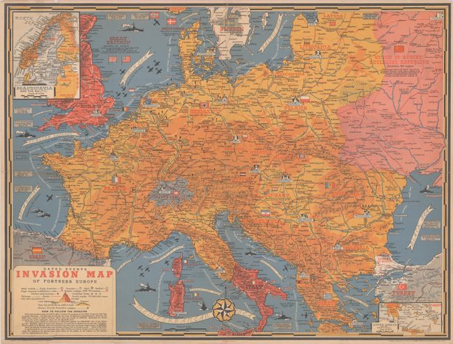
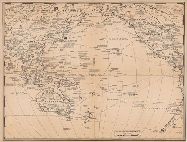
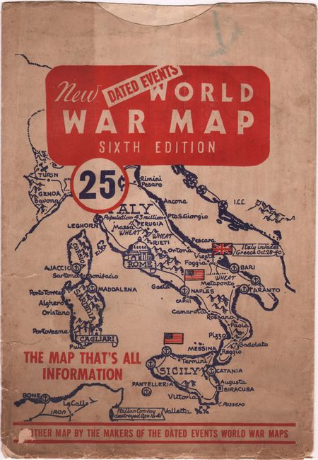
This colorful map by Stanley Turner depicts the European theater of war and is distinctive for its comprehensive depiction of the war with many battles and engagements shown by date. Inset maps in the corners extend to include Scandinavia and southern Greece. A legend at lower left identifies naval bases, battlefields, fortified lines, railroads, canals, pipelines and more. Text below the legend indicates "with this invasion map you will be able to follow the progress of the Allied troops on their way to smash Germany." Decorated by a large compass rose at bottom and numerous ships and aircraft in/over the water. Published by C.C. Petersen in Toronto. The verso contains a large black & white map of the Pacific theater of war showing naval stations and key battle dates. Accompanied by its original envelope entitled "New Dated Events World War Map - Sixth Edition."
References:
Condition: B+
Issued folding with two tiny splits at the fold junctions, light wear along the fold lines, and a few minor extraneous creases. Accompanying envelope is soiled with several small tears along the left edge.