Catalog Archive
Auction 188, Lot 307

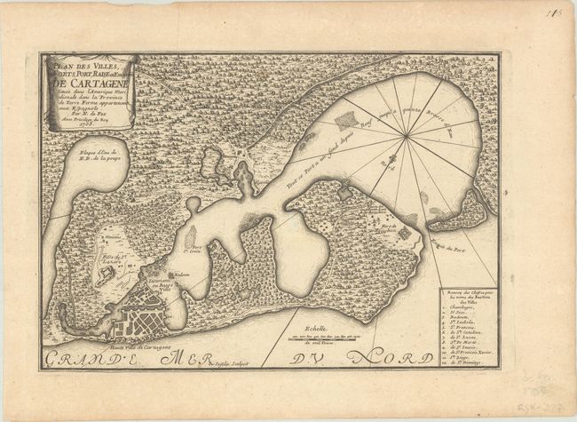
"Plan des Villes; Forts, Port, Rade et Environ de Cartagene Situee dans l'Amerique Meridionale dans la Province de Terre Ferme Appartenant aux Espagnols", Fer, Nicolas de
Subject: Cartagena, Colombia

Period: 1705 (dated)

Publication: L'Atlas Curieux ou le Monde...

Color: Black & White

Size:
12.8 x 8.8 inches
32.5 x 22.4 cm
Download High Resolution Image
(or just click on image to launch the Zoom viewer)

This map of Cartagena and the surrounding bay depicts the important port city as a bird's-eye plan with a numbered key identifying 12 locations. Three forts surrounding the city and bay are shown. The surrounding countryside is filled with vegetation, trails, and a hew houses. A fleur-de-lis orients north to the bottom left of the map. Adorned with a drape-style cartouche and engraved by C. Inselin. This is the second state.

References: Kapp (MCC-77) #39; Pastoureau, FER I D.

Condition: B+

A dark impression with a small hole at center, a couple of small stains, and minor toning and foxing.

Estimate: $160 - $190

Unsold

Closed on 6/22/2022

Archived