Subject: San Antonio, Texas
Period: 1850 (published)
Publication: Sen. Ex. Doc. 32, 31st Congress, 1st Session
Color: Black & White
Size:
5.8 x 8.8 inches
14.7 x 22.4 cm
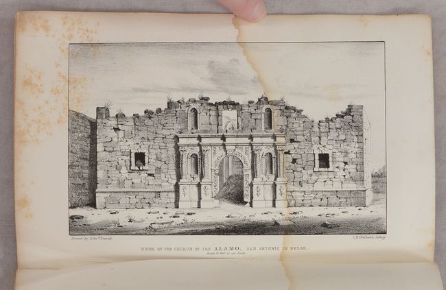
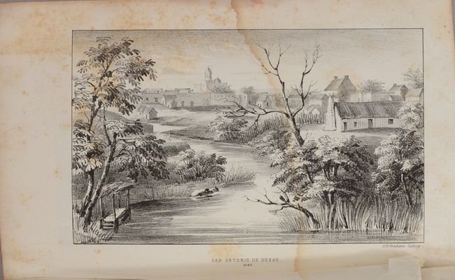
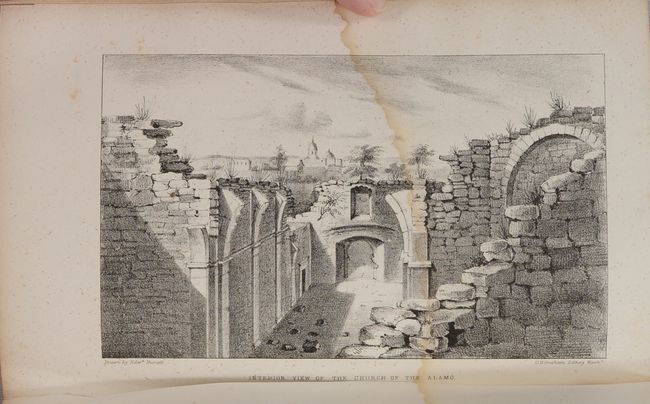
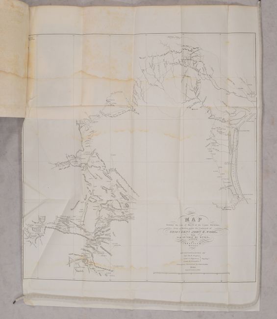
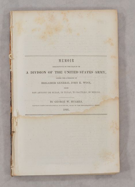
This rare report by Capt. George W. Hughes related to the Alamo contains a folding map (1 of 2) and all 8 lithographed plates showing early views of the Alamo, San Antonio and vicinity. Hughes served as a topographical engineer under Brigadier General John E. Wool. The plates include the first view of the Alamo to be lithographed from an eyewitness drawing, and the two earliest views of the interior and exterior of the Alamo in ruins. The map is entitled Map Showing the Line of March of the Centre Division, Army of Mexico, under the Command of Brigr. Genl. John E. Wool, from San Antonio Bexar, Texas to Saltillo, Mexico…1846 (18.2 x 19.3") and covers the route of General Wool's military expedition during the Mexican-American War. It provided extensive knowledge of an area virtually unknown prior to the war, and details the reconnaissance by Capt. George W. Hughes, and Lieutenants Sitgreaves and W.B. Franklin. The list of plates include:
1) "San Antonio de Bexar 1846."
2) "Ruins of the Church of the Alamo, San Antonio de Bexar. Scale 10 feet to an Inch, 1850." By Everett.
3) "Interior View of the Church of the Alamo." By Everett.
4) "Plan of the Ruins of the Alamo near San Antonio de Bexar 1846." By Everett.
5) "Mission Concepcion, Near San Antonio de Bexar" By Everett.
6) "Mission of San Jose Near San Antonio de Bexar" By Everett.
7) "Church near Monclova. "
8) "Watch Tower Near Monclova."
Five of the plates, including the Alamo images, are from the watercolors drawn by the London-born artist Edward Everett (1818-1903). After coming to the United States in 1840, Everett served in the Mormon War and the Mexican-American War. He came to Texas as part of Wool’s division, which eventually made its headquarters in San Antonio where Everett made his drawings. A fascinating and historical report. Disbound, 67 pages, 1 map, and 8 lithographic plates.
References: Howes #H-767.
Condition: B
The folding map has a binding trim at left and an associated 1.25" binding tear. There are light dampstains along the upper horizontal fold and along the bottom border. Plates and disbound text have scattered foxing and dampstains occupying the lower third of the pages.