Subject: Mid-Atlantic United States, Civil War
Period: 1861 (circa)
Publication:
Color: Hand Color
Size:
23 x 19.7 inches
58.4 x 50 cm
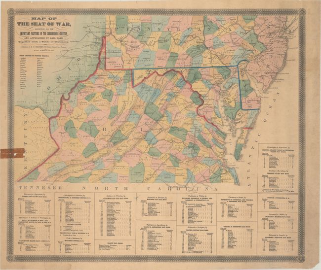
This rare, separately issued map was published shortly after the onset of the Civil War. It is particularly noteworthy for the inclusion of a list of 33 "Union Counties of West Virginia" below the title. On October 24, 1861 citizens in 39 western Virginia counties voted overwhelmingly to form a new Unionist state. Initially named Kanawha, the new state changed its name to West Virginia on November 26, 1861.
Cartographically, the map covers Virginia, Maryland, Delaware, the southern parts of Pennsylvania and New Jersey, and portions of Kentucky and Ohio. It names and locates county seats, courthouses, rivers, and the all-important railroad network. Tables at bottom show distances between important cities including Alexandria to Staunton (Manassas Gap Rail Road), Washington to Lynchburg (Orange & Alexandria Rail Road), and Richmond to Covington (Virginia Central Rail Road). Surrounded by a decorative border.
This map is not listed in Stephenson's Civil War Maps, nor could we locate any past sales records or institutional examples.
References:
Condition: B
Contemporary color with light toning and minor soiling. There is an old tape repair on recto at left with some related small image loss that has been reinforced on verso with archival materials. A number of small tears mostly along the sheet edges have also been archivally repaired on verso.