Subject: Atlases
Period: 1845 (published)
Publication:
Color: Hand Color
Size:
14.3 x 17.5 inches
36.3 x 44.5 cm
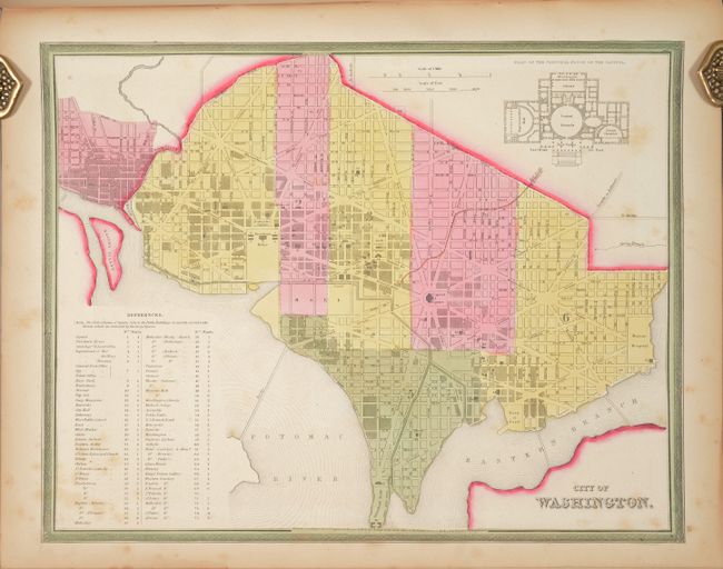
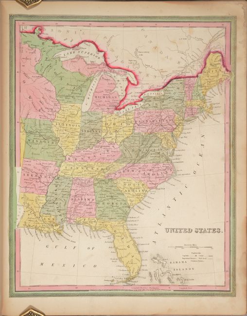
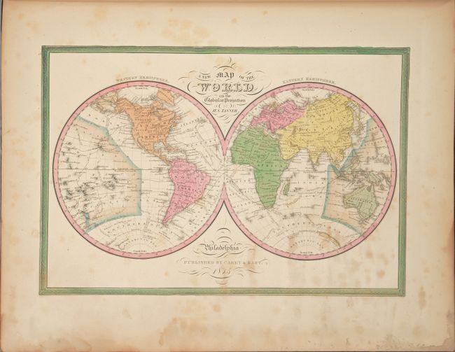
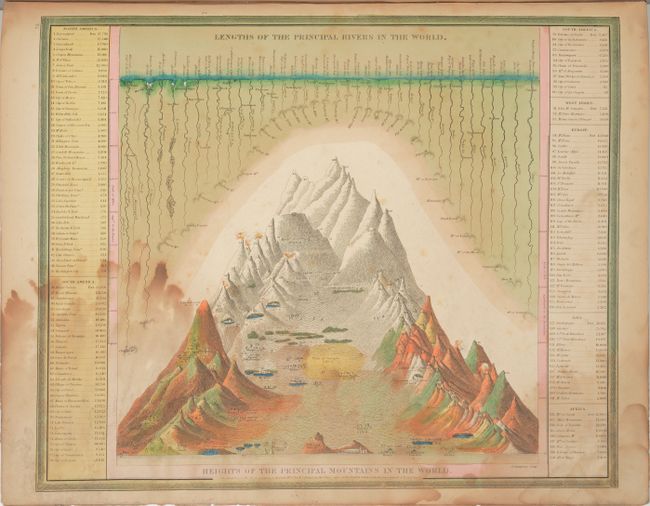
This is the complete, Mitchell edition of Tanner's important New Universal Atlas, which was created to appeal to a broader market than his earlier and more costly American Atlas. This complete example contains a total of 72 single-page maps, with 36 maps dedicated to North America including city plans of New York, Philadelphia and Washington, and the balance featuring South America, Europe, Asia, Africa, and Oceania. The atlas includes the thematic Heights of the Principle Mountains in the World as the frontispiece.
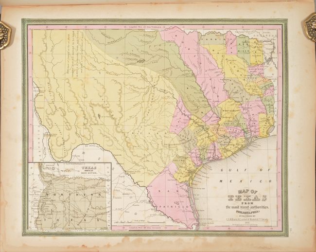
Of particular interest is the map of Texas entitled Map of Texas from the Most Recent Authorities, which is a very early map of the new state drawn by J.H. Young. It portrays early counties, towns, and villages and shows "Texas North of the Red River" in an inset at lower left. This panhandle extends north to the Green Mts., just west of Pikes or James Peak in present-day Colorado, and west to the Rio Grande River, thus incorporating Santa Fe and Taos. There is a comment taken from Arrowsmith's 1841 map in West Texas that the area "as far as North Canadian Fork was explored by Le Grand in 1833, [and] it is naturally fertile, well wooded, and with a fair proportion of water." San Patricio County occupies the southern tip, while Bexar, Milam, and Robertson counties take up the majority of the western region. Several early roads are depicted including the Presido Road, and Fort Alamo, mines, and the Presidios of Rio Grande, del Norte el de las Yuntas, del Paso del Norte are identified.
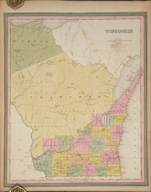
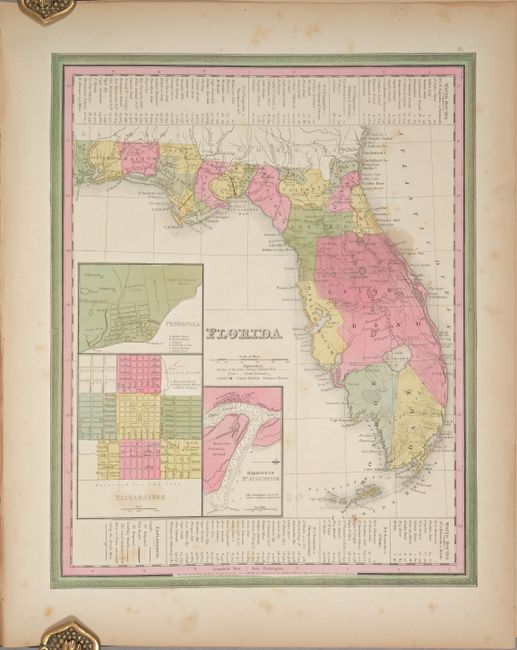
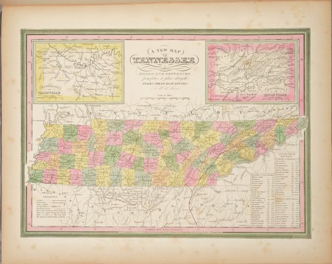
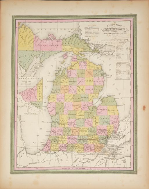
Also of interest is the map of Iowa Territory, which depicts 20 counties clustered along the Mississippi River in the southeast. There are a number of early settlements (many of which no longer exist) and roads depicted in this region. The majority of the territory is divided among Indian nations; the Sioux in the north, and the Sauks and Foxes, Iowas and Pottawattamies in the south - separated by a large swath through the middle labeled Neutral Ground. County development is current to 1843, just prior to Iowa's admission as a state. Other notable maps include Florida, Wisconsin, Tennessee, Louisiana, and Michigan.
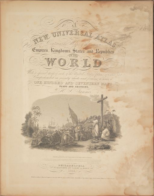
Contents include a decorative title page, table of contents, maps and plans. Title page has engraved "First Landing of Columbus in the New World" with his three ships in the background. Contemporary quarter black leather and tips over original black cloth boards with original gilt embossed title label on front cover.
Henry Schenck Tanner was one of the principal figures during the American "Golden Age of Cartography" (1820-40). His New Universal Atlas set the standard and his work enjoyed lasting commercial success as the publishing rights were bought by Carey & Hart from 1843-45, Samuel Augustus Mitchell from 1846-50, Thomas, Cowperthwait & Company from 1850-55, and Charles Desilver from 1856-58.
References:
Condition: B
The maps have bold contemporary color and the majority are in very good condition (B+) with light, scattered foxing. There is a dampstain along the fore-edge that affects the comparative mountains frontispiece, title page, list of maps, and world map; the dampstain has minor impact on about a dozen other maps, mostly in the blank margin. The front free-endpaper is torn. The front cover is detached and heavily worn and the back cover has some abrasions and bumped corners. The spine has a chip at top. This example is a good candidate for professional rebinding.