Subject: El Paso, Texas
Period: 1945 (circa)
Publication:
Color: Black & White
Size:
13.4 x 19.3 inches
34 x 49 cm
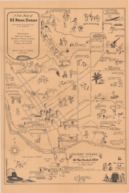
This charming tourist map names El Paso the "sunshine playground" with "80% sunshine." It shows the major roads and highways and important buildings and places of interest, such as San Jacinto Plaza, the Coliseum (which had just opened in 1942), Fort Bliss, a border patrol lookout tower, and Franklin mountains. The map extends south across the Rio Grande River to include part of the city of Juarez, Mexico. Whimsical figures enjoying a multitude of activities fill the map. On verso is additional information on El Paso and Juarez, as well as 14 "day" trips to sites near El Paso. Published by the El Paso Sunland Club.
References:
Condition: A
Issued folding and printed on tan paper, with tiny holes at fold intersections, very minor soiling, and a light crease at top.