Subject: Texas, United States
Period: 1945 (dated)
Publication:
Color:
Size:
8.7 x 11.1 inches
22.1 x 28.2 cm
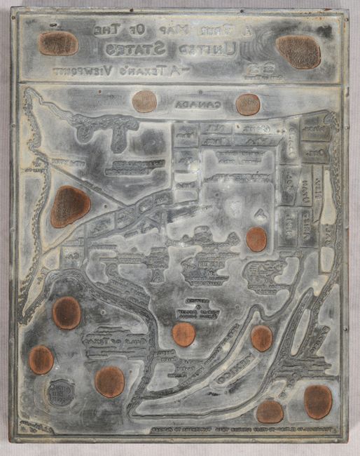
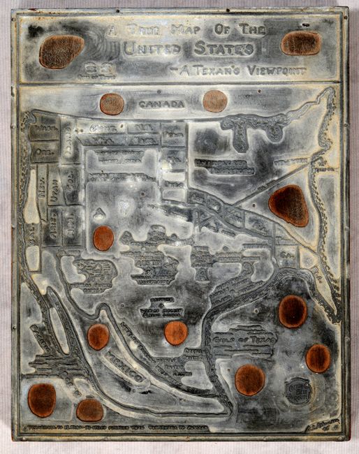
This unique offering is the original printer's plate used to produce paper copies of A True Map of the United States – A Texan’s Viewpoint by A.L. Atkinson. The metal plate is created with the image in reverse and is mounted to wood. The resulting map presents the state extending to nearly the Canadian border and is replete with various superlative claims including: finest cattle, biggest vegetable garden, richest university, and biggest oil field. Shows the Great Lakes ("A Few Lakes") area as “Unexplored Territory” and the Gulf of Mexico renamed as the Gulf of Texas. The plate features the insignia of the Cotton Belt Route, which would indicate it was produced for the St. Louis Southwestern Railway (which operated that route). We found only one past dealer listing and one institutional example on OCLC for the map.
The second image has been digitally reversed and enhanced for easier study.
References:
Condition: B+
There is a tiny chip at upper center, some light soiling, and a bit of oxidation, but overall in very good condition for its intended use. The second image has been digitally reversed and enhanced for easier study.