Subject: Western Hemisphere - America
Period: 1763 (circa)
Publication:
Color: Hand Color
Size:
21.6 x 19.7 inches
54.9 x 50 cm
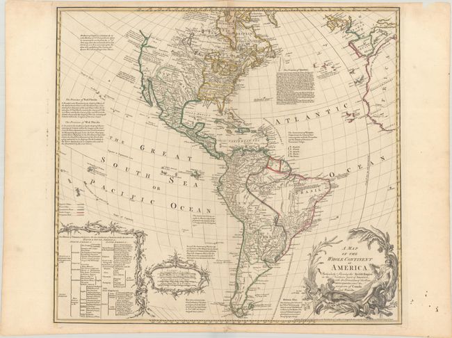
This very uncommon map of the Americas focuses on the colonial possessions in the Americas, with a colored key at left to British, French, Spanish, Dutch and Portuguese possessions. Britain is shown in control of the entire eastern part of North America, and Spain is in control of the western portion. The western coast is labeled New Albion and both the Sea of the West and River of the West are named, but not delineated. A table outlining the colonial possessions is included at bottom left. The map is filled with interesting notations concerning discoveries, treaties, and cartographic misconceptions, such as one that notes that California was once believed to be an island. The large title cartouche features an Amazon queen, cherubs, a beaver and a crocodile.
References: McGuirk #113.
Condition: A
A nice impression with contemporary outline color on a bright sheet with a Strasbourg Lily watermark. There is light soiling along the edges of the sheet and a chip at top right, well away from the image.