Subject: Holy Land
Period: 1646 (published)
Publication:
Color: Hand Color
Size:
19.2 x 13.4 inches
48.8 x 34 cm
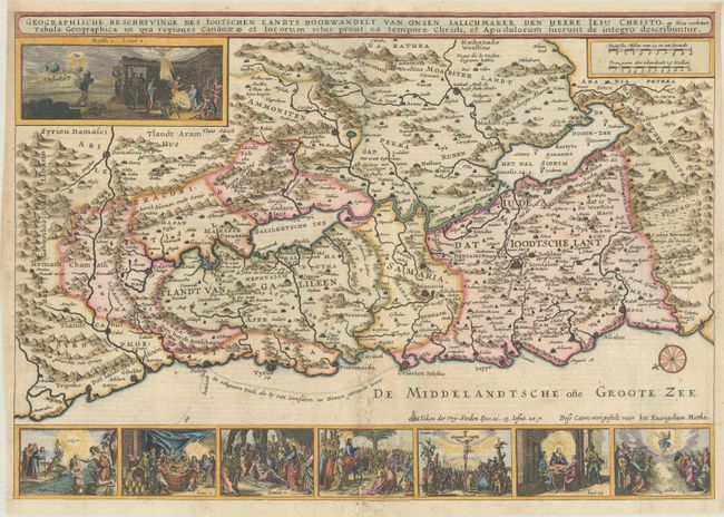
This is a fine Bible map of the Holy Land with north oriented to the left. The map is richly engraved and decorated with eight vignettes of scenes from the bible, including the birth of Jesus at top left and his crucifixion at bottom. The track of Apostle Paul's journey to Rome is shown in the Mediterranean Sea. Dutch text on verso.
Although Danckerts copied many maps from Claes Janszoon Visscher, the vignettes in this map appear to be Danckerts' own creation. The two families were fierce competitors in the mid-seventeenth century, both of whom had their businesses located on the same street in Amsterdam. Danckerts' map is quite rare.
References: Poortman & Augusteijn #105.
Condition: B+
A darg impression on a bright sheet with a coat of arms watermark and some light soiling along the centerfold at bottom. There are professional repairs to some separations along the centerfold and to a few small holes in the bottom blank margin.