Subject: Eastern Mediterranean & Middle East
Period: 1721 (circa)
Publication: Geographia Classica
Color: Black & White
Size:
9 x 6.2 inches
22.9 x 15.7 cm
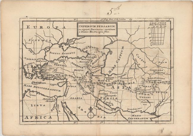
This handsome map of the Persian Empire was published in an edition of Moll's Thirty Two New and Accurate Maps of the Geography of the Ancients (or Geographia Classica), which was published in various editions from 1721 to ca. 1795. It depicts the Achaemenid Empire (or First Persian Empire) under the rule of Darius the Great, who reigned from 522 BCE until his death in 486 BCE. Darius the Great divided the empire into provinces or satrapies, which are delineated here. The map includes a scale of British miles for longitude at top right.
References: McCorkle (18th C. Geography Books) #284-5; Shirley (BL Atlases) T.MOLL-5a #5
Condition: B+
On watermarked paper with light toning along the centerfold, minor offsetting, and an old manuscript ink notation in the top blank margin.