Catalog Archive
Auction 184, Lot 526

"Parte Orientale del Regno di Boemia di Nuova Projezione", Zatta, Antonio
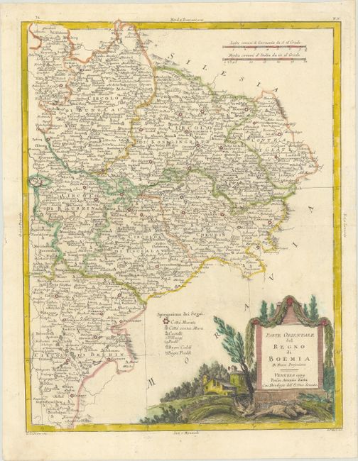
Subject: Eastern Czech Republic

Period: 1779 (dated)

Publication: Atlante Novissimo

Color: Hand Color

Size:
12.1 x 15.8 inches
30.7 x 40.1 cm
Download High Resolution Image
(or just click on image to launch the Zoom viewer)

This finely engraved map covers eastern Bohemia from Prague east to Glatz. The region is divided into circolos (okres). A key identifies cities (both walled and without walls), castles, villages, postal stops, and hot and cold baths. At bottom right there is a decorative title cartouche depicting a rural scene. Drawn by G. Zuliani and engraved by G. Pitteri.

References: Shirley (BL Atlases) T.ZAT-1a, Vol. 2 #5.

Condition: A

Full contemporary color on a sheet with two crescent moon watermarks and a tiny hole in an unengraved area above the title cartouche.

Estimate: $120 - $150

Sold for: $90

Closed on 9/15/2021

Archived