Subject: Scandinavia, Sweden
Period: 1720 (circa)
Publication: Atlas Historique
Color: Black & White
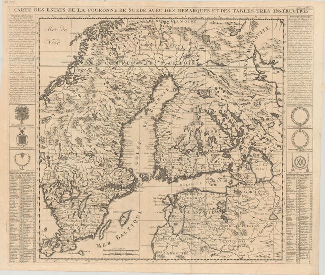
A. Carte des Estats de la Couronne de Suede avec des Remarques et des Tables Tres Instructives, (23.3 x 19.7"). This map shows most all of Finland, Sweden, and Norway, save the northern reaches, and includes much of the Baltics. The map extends into Russia to locate Nyskantz F. de la Nie (St. Petersburg) and westward to include Zealand. It is precisely engraved to include scores of towns and villages, watershed, and coastal details. With text and coats-of-arms at the sides. Condition: Issued folding on a sheet with an elephant watermark. There is minor toning and a couple short tears around one of the fold junctions.
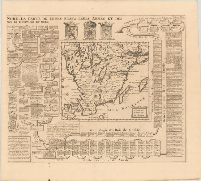
B. Carte du Royaume de Gothie, (18.3 x 15.1"). This is the right-hand sheet of Chatelain's two-sheet engraving Carte Genealogique pour Conduire a l'Histoire des Rois du Nord... It includes a nicely detailed map of Gotaland that extends to include the islands of Zealand, Bornholm, Oland, and Gotland. Above the map are the arms of Gotaland, Sweden, and Stockholm. The map is surrounded by a portion of an elaborate family tree detailing the royal lineage of Scandinavia. Condition: On a sheet with a Strasburg bend and lily watermark and a couple edge tears, including one at top that barely crosses the neatline and has been closed on verso with archival tape.
References:
Condition: B+
See description above.