Subject: Paramaribo, Suriname
Period: 1773 (circa)
Publication:
Color: Hand Color
Size:
12.3 x 7.4 inches
31.2 x 18.8 cm
Lovely pair of maps detailing Paramaribo, which was colonized by the Dutch in South America.
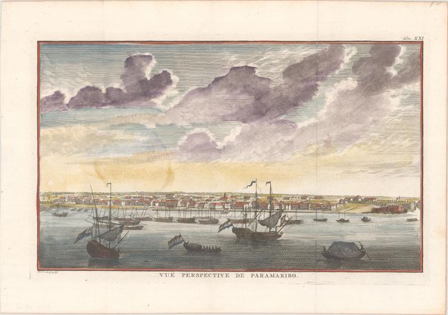
A. Vue Perspective de Paramaribo (12.3 x 7.4"). This lovely view shows the Dutch settlement of Paramaribo, with the fort at far right and numerous ships in the sea. Condition: Excellent impression, issued folding on a bright sheet with a fleur-de-lis watermark and a faint dampstain in the sky at left. An old stamp is lightly visible on verso. (B+)
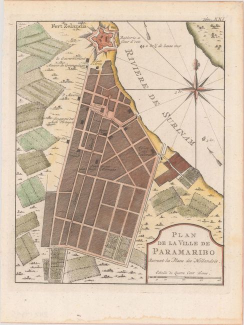
B. Plan de la Ville de Paramaribo Suivant les Plans des Hollandois (6.5 x 8.2"). This plan of Paramaribo notes the Fort Zelandia at the mouth of the Suriname River, and important buildings such as the churches, government buildings, and the butcher. The surrounding countryside is a patchwork of cultivated fields, and the river notes soundings and current flow. A large compass rose orients the map. Condition: A crisp impression on a bright sheet with a faint dampstain along the bottom edge of the sheet. (A)
References:
Condition:
See description above.